

Digital Survey of the Quinta da Arealva
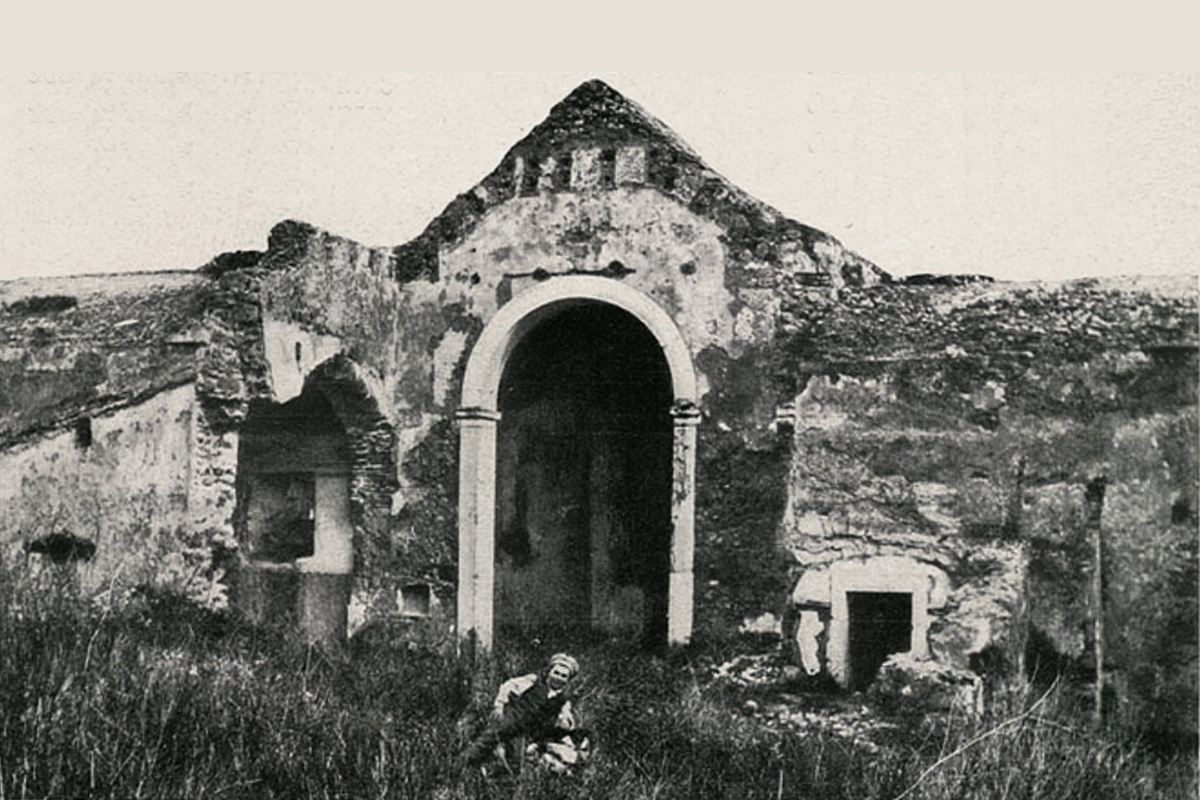
The Quinta da Arealva is a historic site in Almada, Portugal, located along the Tagus River. It is currently in a state of ruin following the discontinuation of its use as an agricultural estate for wine production. Today the site houses the remains of this former estate including several dependencies such as a palace and various structures previously dedicated to winemaking, such as warehouses, cooperages, a river pier, a shipyard and several residential structures.
Some of these have historical significance, like the ancient warehouses and cooperage, which were constructed in the 18th century Pombaline architectural style adopted to reconstruct the city of Lisbon and surrounding areas following the 1755 earthquake.
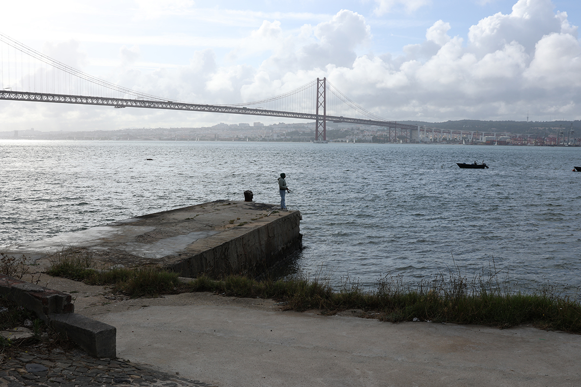
Originally, the Quinta was built as a military fortification in the 17th century to oversee sea vessels along the Tagus River as part of a maritime defense system. However, by the end of the 18th century, it lost its military significance, and was repurposed for wine production. At this stage in its history, the Quinta da Arealva encompassed extensive land, including multiple houses and vineyards and had its own pier on the Tagus River for transporting wine.
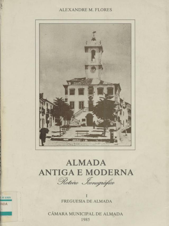
Alexandre M. Flores, Almada Antiga e Moderna, Câmara Municipal de Almada, 1985.
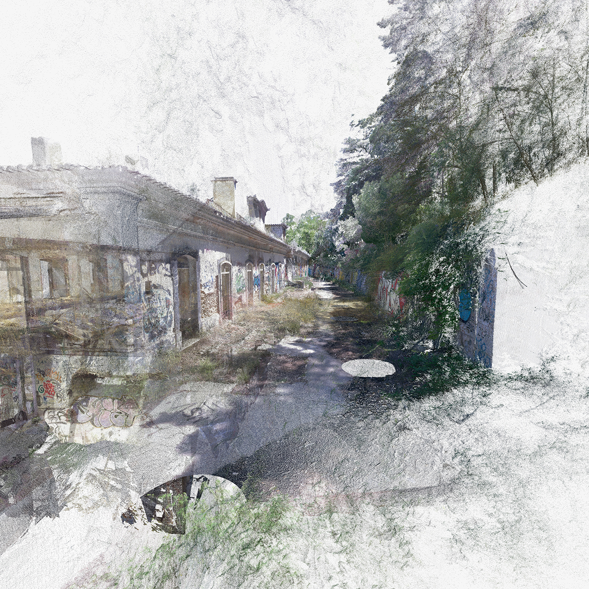
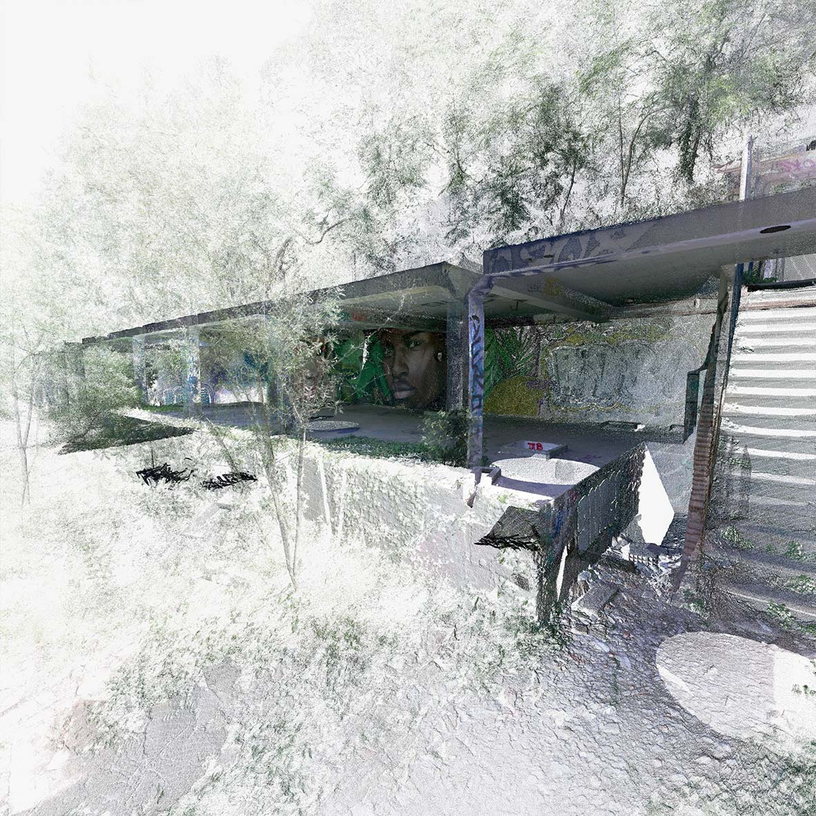
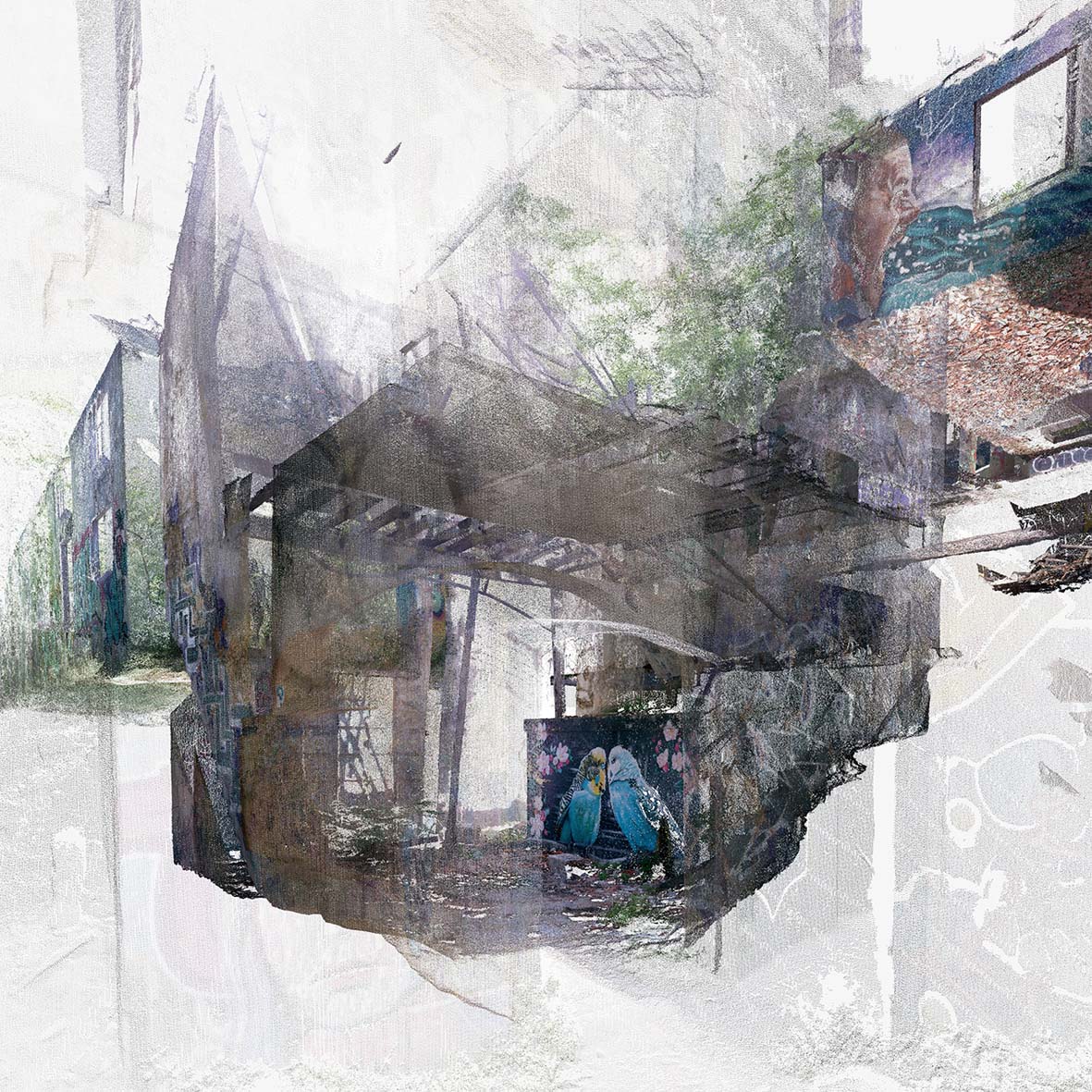
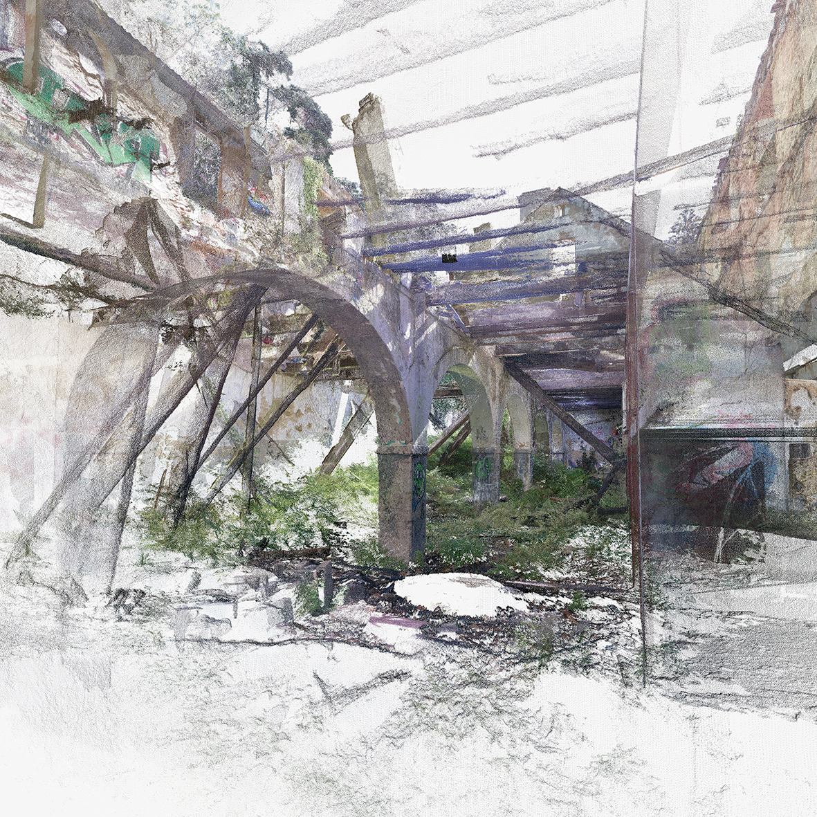
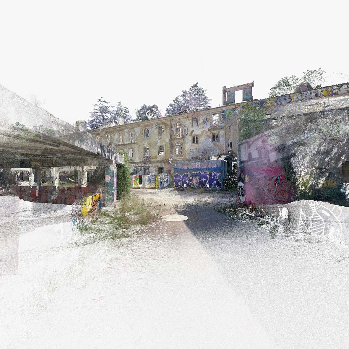
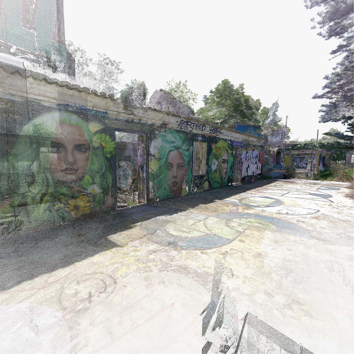
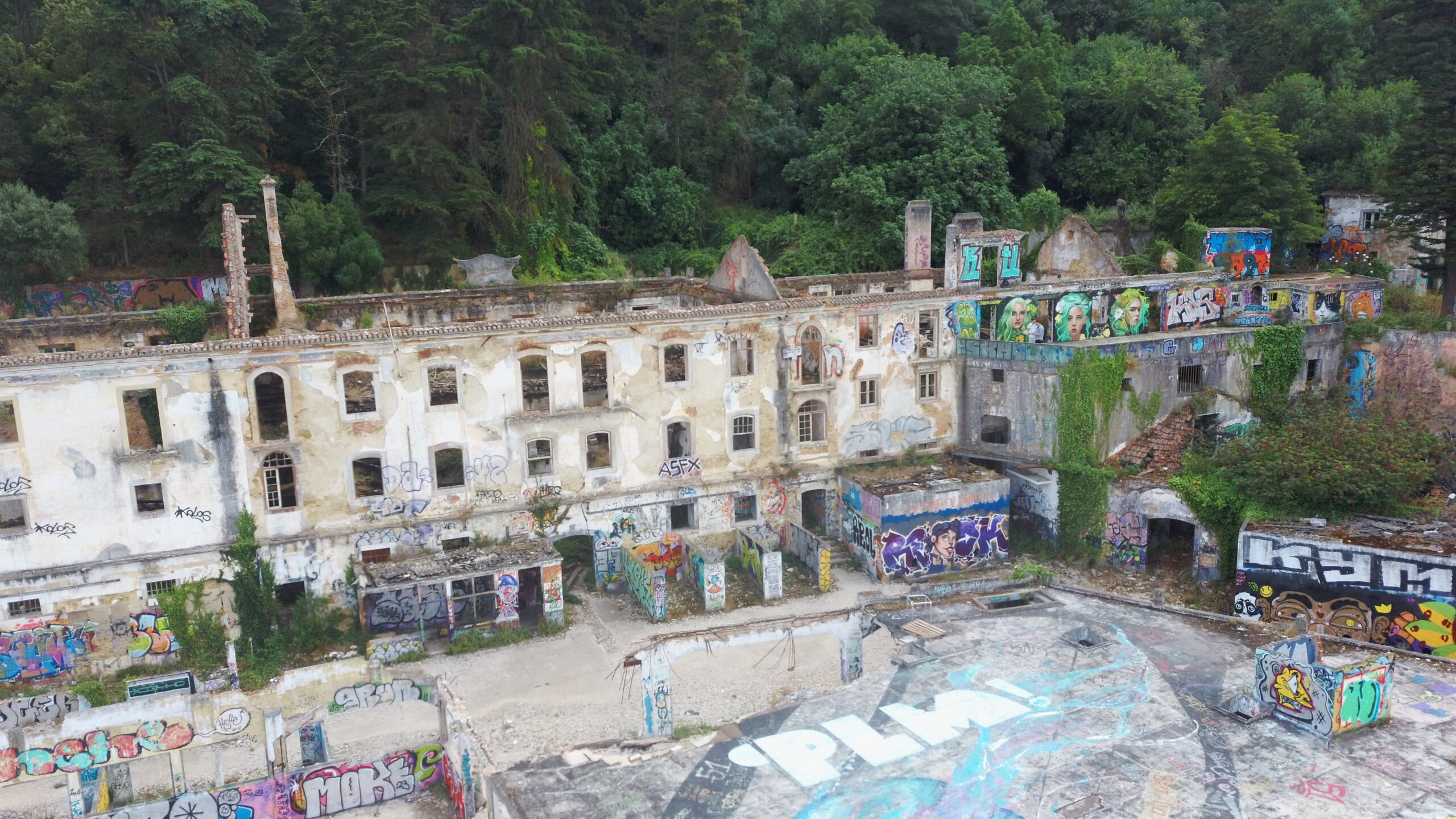
Subsequently, the complex fell into a state of abandonment and since the early 21st century, the buildings have largely degraded as a result of looting and vandalism. Today the space is left open for exploration, and the pier is a popular fishing site for locals and has even used as an informal stage for music festivals. With collapsed roofs, many of the spaces within the ruins been reclaimed by the forces of nature in interesting ways, creating spontaneous garden-like spaces surrounded by large wall paintings. For these reasons, curious locals and tourists frequently explore the ruins to experience the curious layers of nature and art that accumulated there. Given its popularity and its spectacular location across from the city of Lisbon, there is great interest and potential in restoring the area as part of a pedestrian route project to continue the beautification of the Ginjal pier.
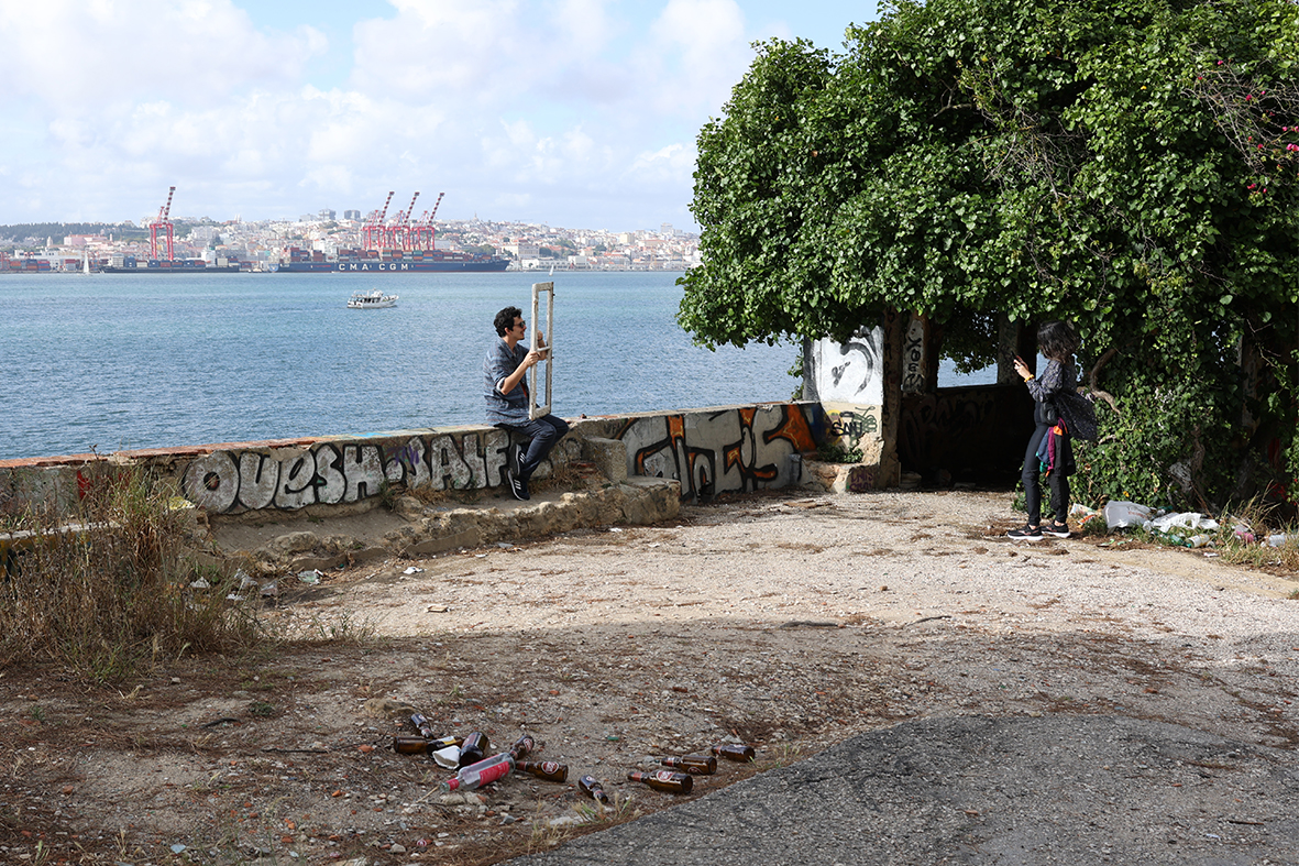
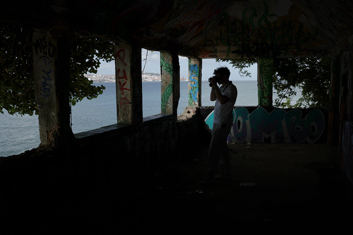
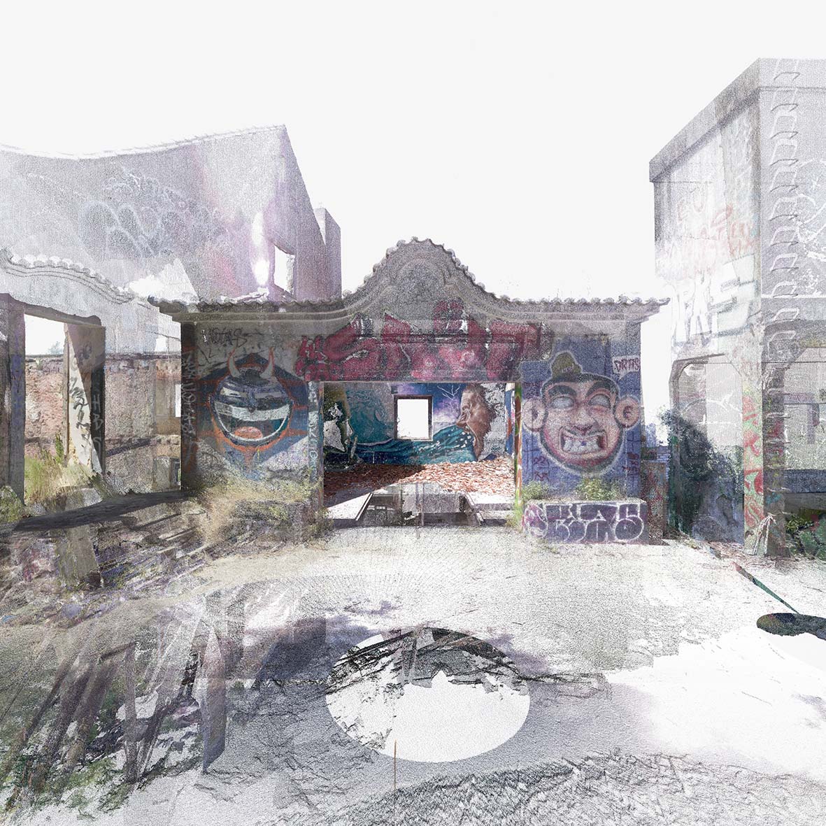
Images from the site visit.
Subsequently, the complex fell into a state of abandonment and since the early 21st century, the buildings have largely degraded as a result of looting and vandalism. Today the space is left open for exploration, and the pier is a popular fishing site for locals and has even used as an informal stage for music festivals. With collapsed roofs, many of the spaces within the ruins been reclaimed by the forces of nature in interesting ways, creating spontaneous garden-like spaces surrounded by large wall paintings. For these reasons, curious locals and tourists frequently explore the ruins to experience the curious layers of nature and art that accumulated there. Given its popularity and its spectacular location across from the city of Lisbon, there is great interest and potential in restoring the area as part of a pedestrian route project to continue the beautification of the Ginjal pier.In 2023, the digital surveying of Quinta da Arealva was undertaken as a collaboration between Tokyo College (The University of Tokyo), Instituto Superior Técnico and Karlsruher Institut für Technologie. The work involved two main processes. The first was terrestrial laser scanning to capture facades and interiors. The second uses aerial photogrammetry with a drone to capture roofs and terrain
In the case of the Quinta, there were may obstructions to the interior spaces due to the high state of ruination of the space. However, the obstructions to the scans do not affect the accuracy of the results, meaning that we can still achieve a reliable millimetre precise tracing of walls. 77 scans were taken overall. These individual scans were then registered together into Cyclone REGISTER 360. The registration process can connect scans automatically by detecting overlaps between the points of different stations however due to the complexity of the space and obstructions, it was usually necessary to manually select relevant matching point areas.
The scanner settings could be modified on site with a tablet by using Leica’s Cyclone FIELD 360. The application also allows users to preview and register scans together on-site to ensure the quality of the data and verify that connections between the scans are possible. Scans of the highest point density, which take about 6 minutes, were used for the main facade and important interior spaces. Scans of medium point density, which take about 2.5 minutes were used to create links between scans and to create a quick survey of the whole perimeter of the buildings given the time constraints. The final result of the scanning process is a point cloud file composed of numerous scan stations registered together, each containing a 360 photosphere from the built in HDR camera. Each individual point of the data is defined by a three-dimensional coordinate (x, y, z) and an RGB colour.
Sample images of the laser scanning results from the Quinta da Arealva.
To document the Quinta, photogrammetry was also used to capture hard-to-reach areas, such as the roofs or the facades located directly along the Tagus River which cannot be accessed by foot. In the photogrammetric survey of the Quinta, a drone was used to capture 600 high-resolution photographs of the buildings from the air. Afterward, Metashape was used to automatically detect matches between photos, align them, and generate point clouds of the represented surfaces.
The project has been integrated into a master’s thesis by Maikel Hollstein of Karlsruher Institut für Technologie under the supervision of Meinrad Morger. The project uses the digital survey data and historic research conducted over the summer of 2023 to digitally model and propose a speculative rehabilitation of the site which finds a new purpose inspired by the layers of memory that constitute the Quinta’s identity. There will be more updates of the research results to come.
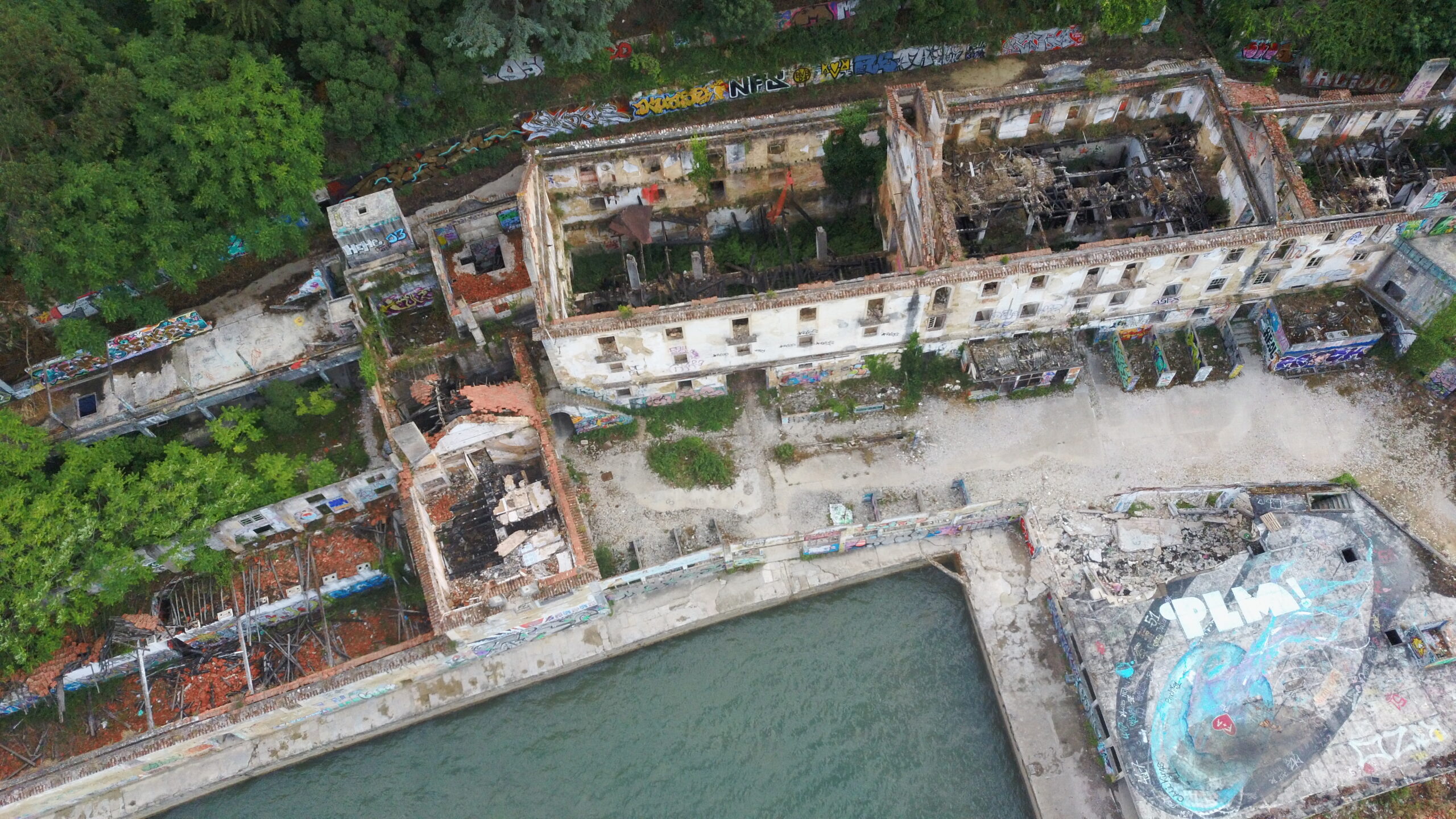
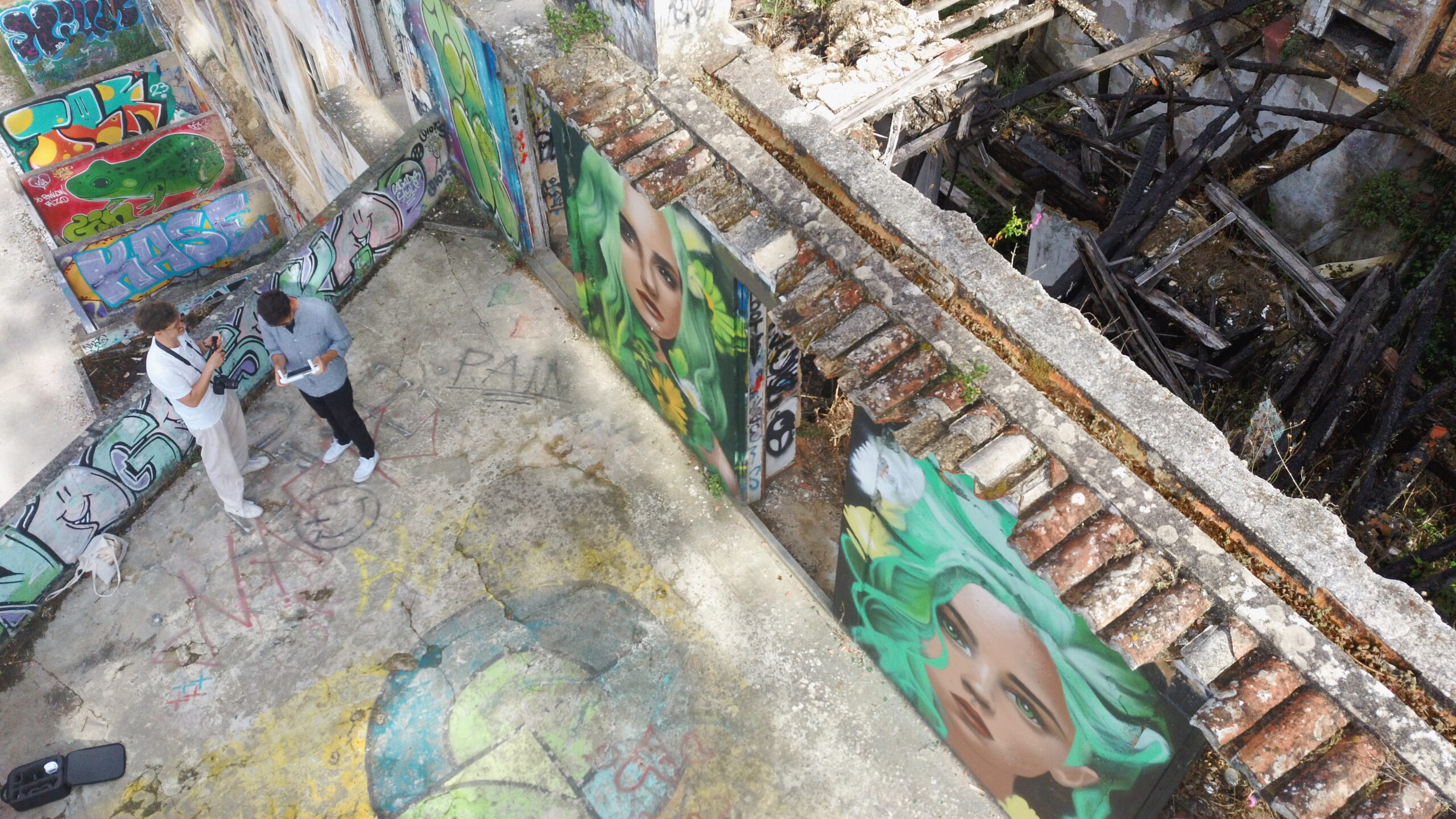
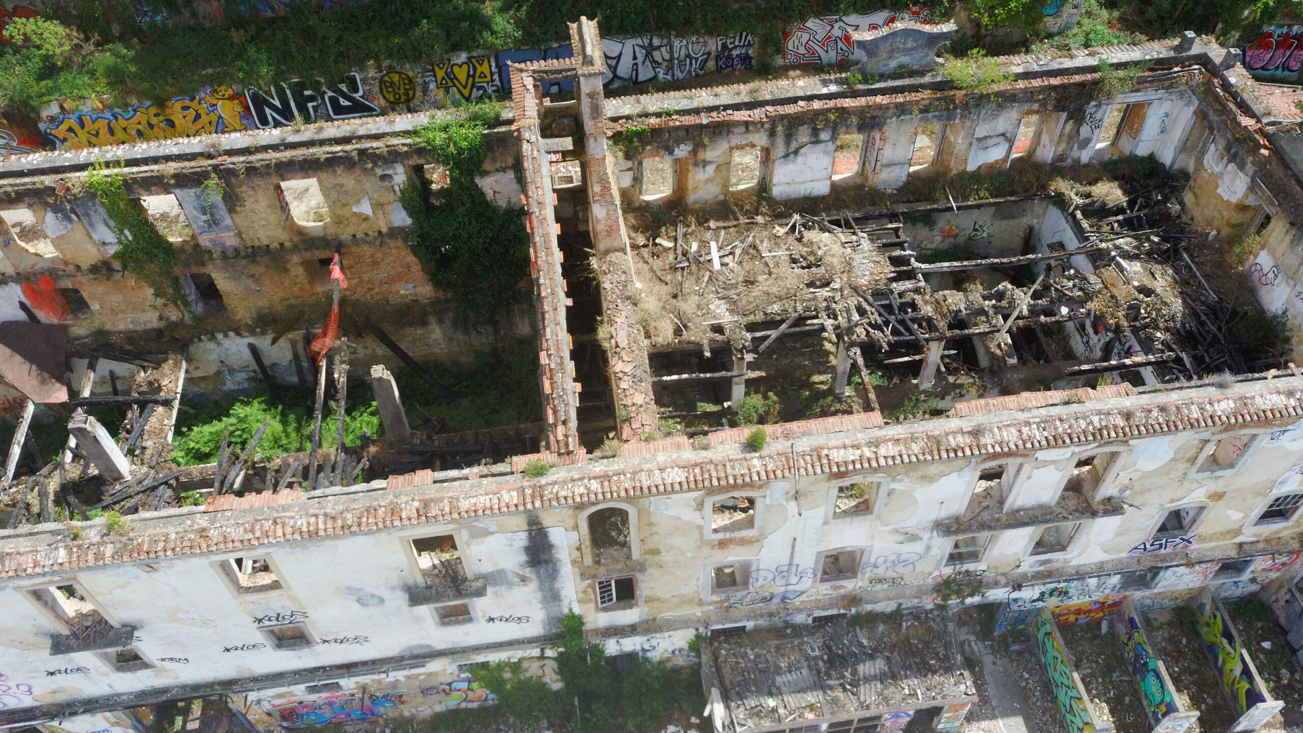
Sample images taken from the drone flight.