

Virtual Visit to the Monastery of Nossa Senhora da Rosa
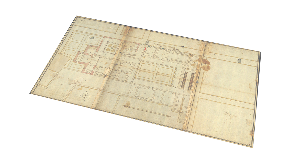
The ruins of the Monastery of Nossa Senhora da Rosa de Caparica are located in the parish of Caparica, municipality of Almada, in a valley between Monte de Caparica and Charneca de Caparica. The monastery belonged to the Order of the Hermits of Saint Paul, the First Hermit, and originated as a hermitage founded in 1410. Today, very little of the building’s ancient traces remain; most of its foundations are on private property. Fortunately, there is a set of drawings in the National Archives of the Torre do Tombo that apparently illustrate two phases of the building’s history: 1) its configuration in the late 16th century and; 2) a remodelling project, by the royal architect Luís de Frias Pereira, perhaps from the beginning of the 17th century (Mendes, 2017). The research presented below recounts the virtual reconstruction of this monastery in its last documented phase of life in the 17th century.
An initial analysis of the drawings revealed several inconsistencies. Doors and windows sometimes do not match, section lines often do no conform to their location in the plan, and consistent errors in the representation of vaults was seen across the sections. Some detail drawings were also difficult to locate, as they are not clearly marked on the plans or sections. Several interpretations based on similar existing convents and architectural common-sense were necessary to reconcile the fragmented representations.
A sequence of images showing the model superimposed over the plan by Pereira.
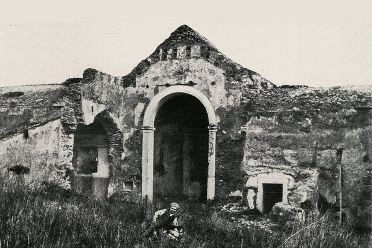
The model was extremely useful in verifying the conformity of historic photographs of the monastery to the architect’s drawings. A comparison between a section of the model and a historical photo from 1913, which depicts the remains of the church before its total demolition, shows that the building, at least in part, could have been built according to the indications of Pereira’s drawing. Several common elements are present: the arch of the apse, the arch of the side chapel, the sacristy, the traces of the vault, and the slope of the apse roof. The profile of the wall that houses the arch of the apse, dividing the latter from the nave highlights one possible discrepancy, though the photograph shows the building at a highly degraded state.
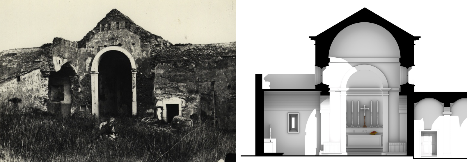
Photograph of the ruin (Remains of the Monastery, Ilustração Portugueza, November 24, 1913.) compared with a section of the digital model taken through the church nave.
After the digital model was completed, several historical sources were superimposed to attempt to relocate the building on its original site. The sources included an excerpt from the Topographical Map of the Peninsula of Setúbal dating from 1816, the 1903 map of the surroundings of Lisbon, and an aerial photo dating from 1940 (where the remains of the church are presumably visible), on a current aerial photo of Caparica. Based on this overlap, a possible relocation was identified which also corresponded to the location where stones once belonging to the monastery now sit.
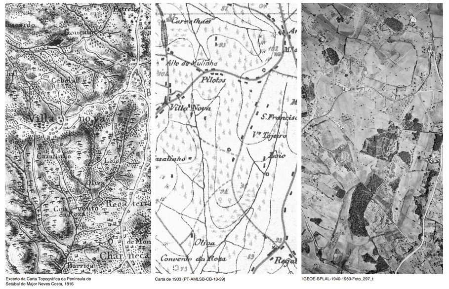
The 3 maps used to speculate on the location of monastery.
A digital survey of these supposed remains was carried out through laser scanning and aerial photogrammetry to determine their plausibility. With the data, a virtual anastylosis was undertaken to digitally reconstruct the curvature of the original arch and to verify, through comparisons with the digital model and the historical photo from 1913, whether it belongs to the church, so as to corroborate the hypotheses mentioned above. By superimposing the photogrammetric meshes of the surveyed ashlars on the 1913 photo, a high compatibility was found between these fragments and the original arch in terms of size, curvature, and decorative elements. Based on this, the diameter of the arch was found to be compatible with Pereira’s drawings.
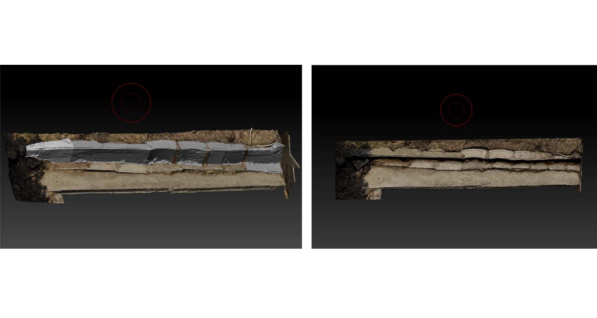
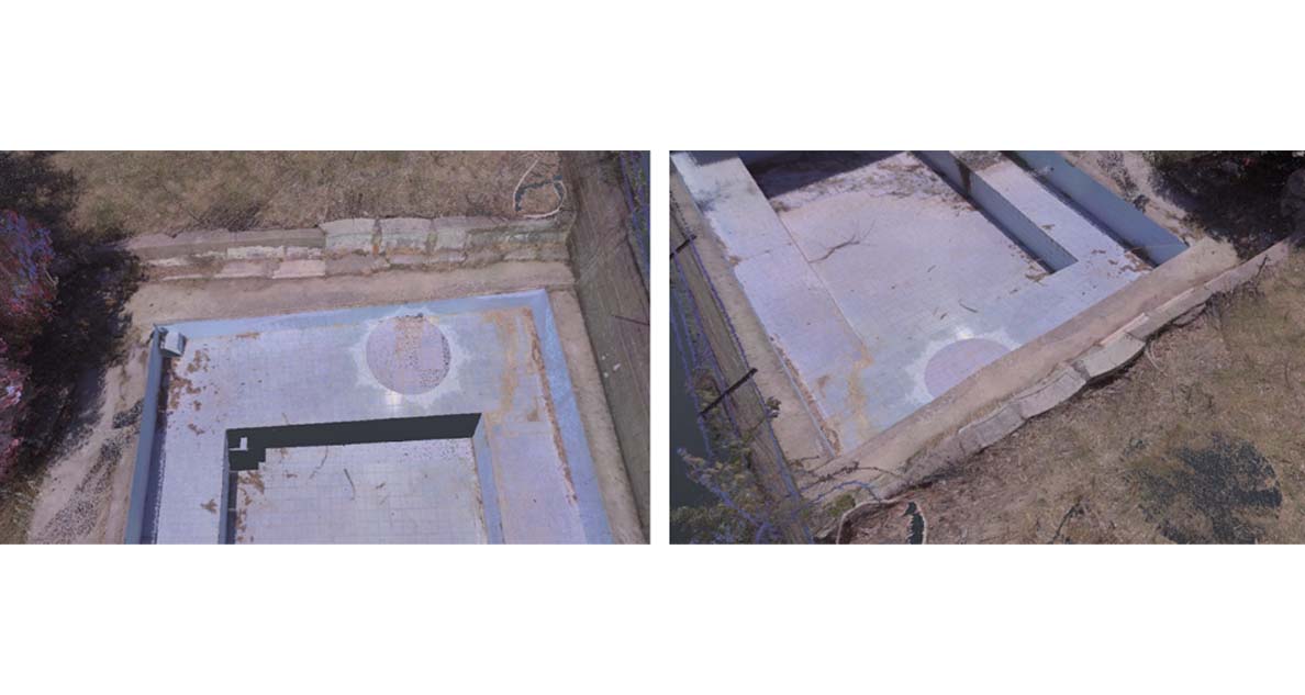
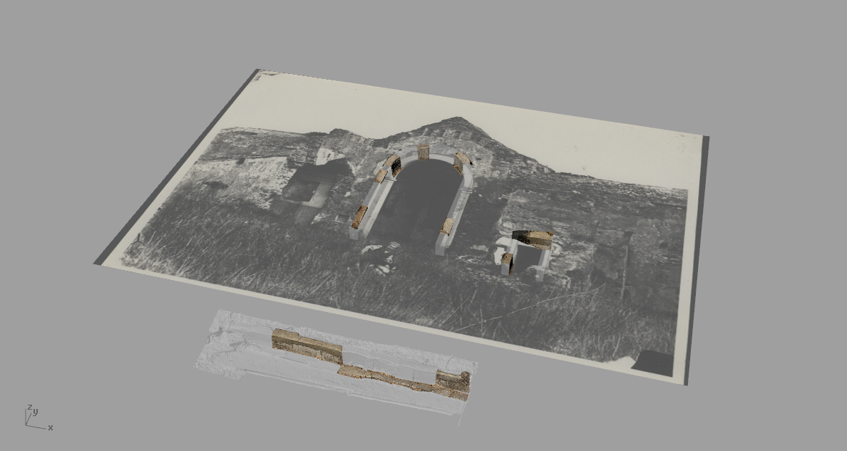
Sequence of images showing the documentation of the found fragments and subsequent virtual anastylosis.
The transition from 2D to 3D helped us question the decisions that had been made and reformulate theories about the possible uses of the spaces that constituted the monastery. The translation of the drawing to 3D allowed, for example, to see some inconsistencies between the drawings that had escaped at first glance. Translation, though, is never complete and entirely consistent with the original text. For this reason, the digital model developed as an outcome of this project is not intended to be an objective reconstruction of the morphological composition of the monastery as of 1593. Rather, the goal of the research was to develop a model capable of highlighting the interpretive process behind the translation work. As a result, the model is unfinished, a reversible and constantly evolving element whose interpretation can be revisited and updated based on future negotiation processes.
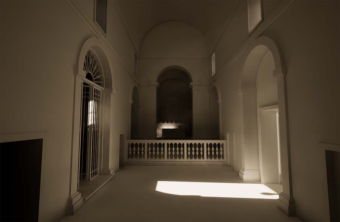
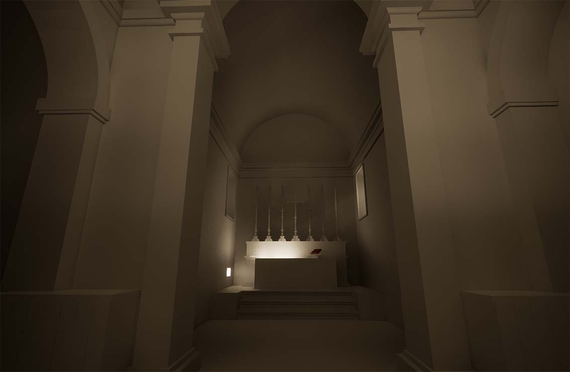
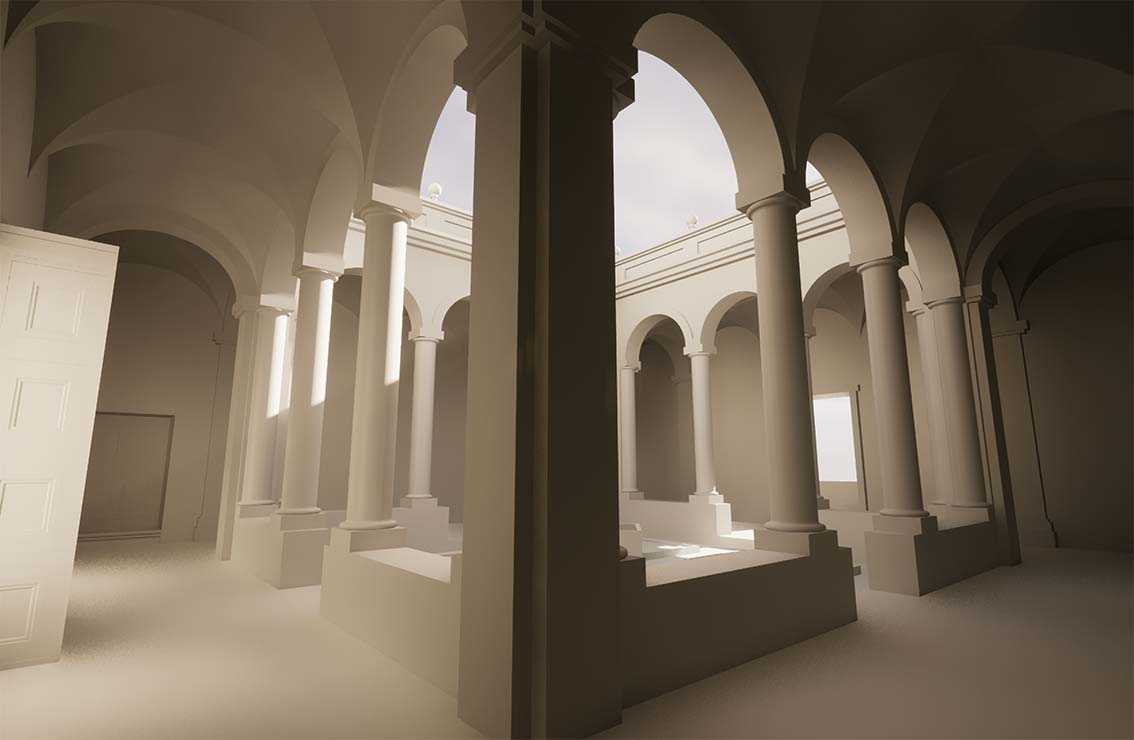
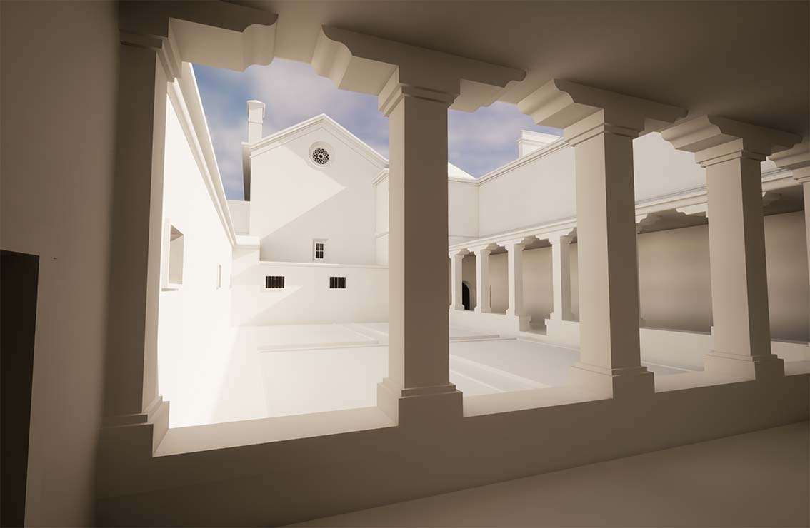
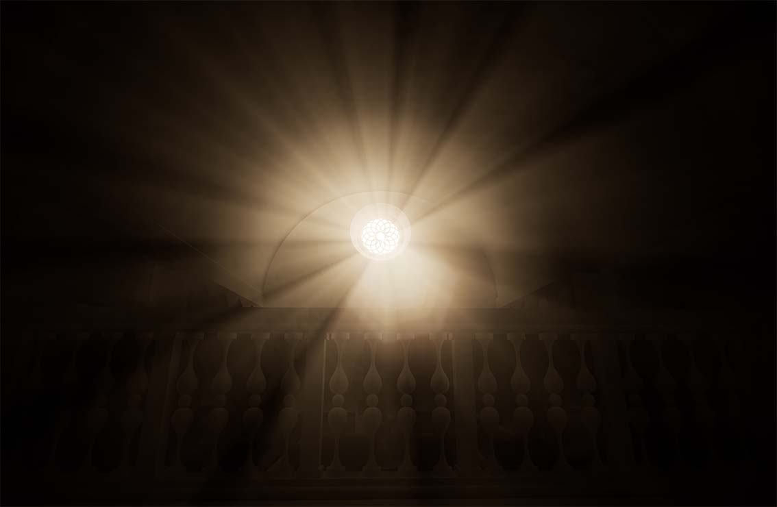
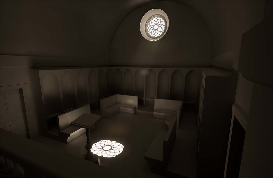
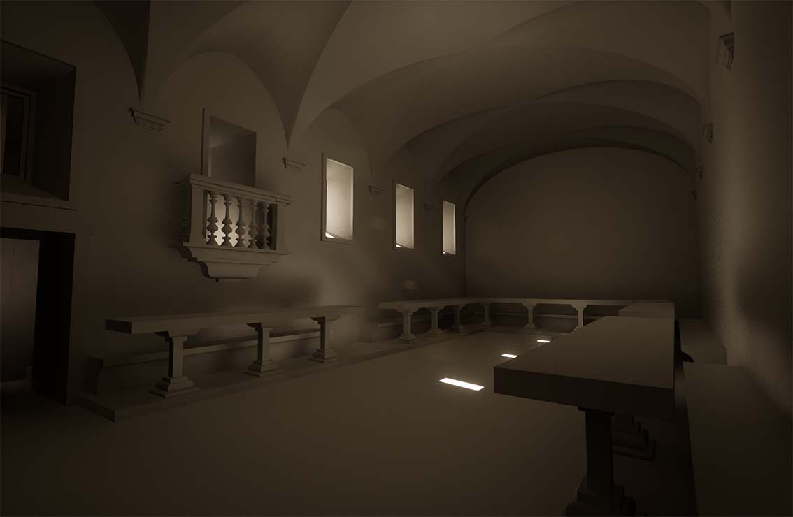
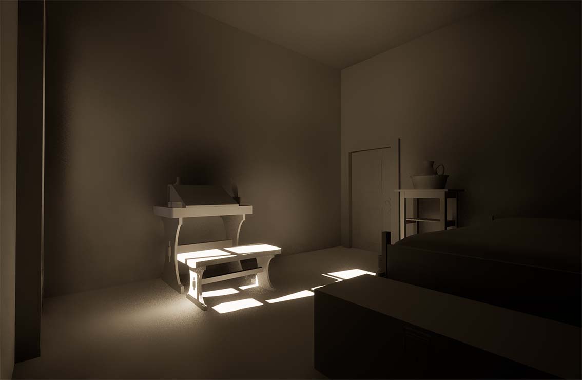
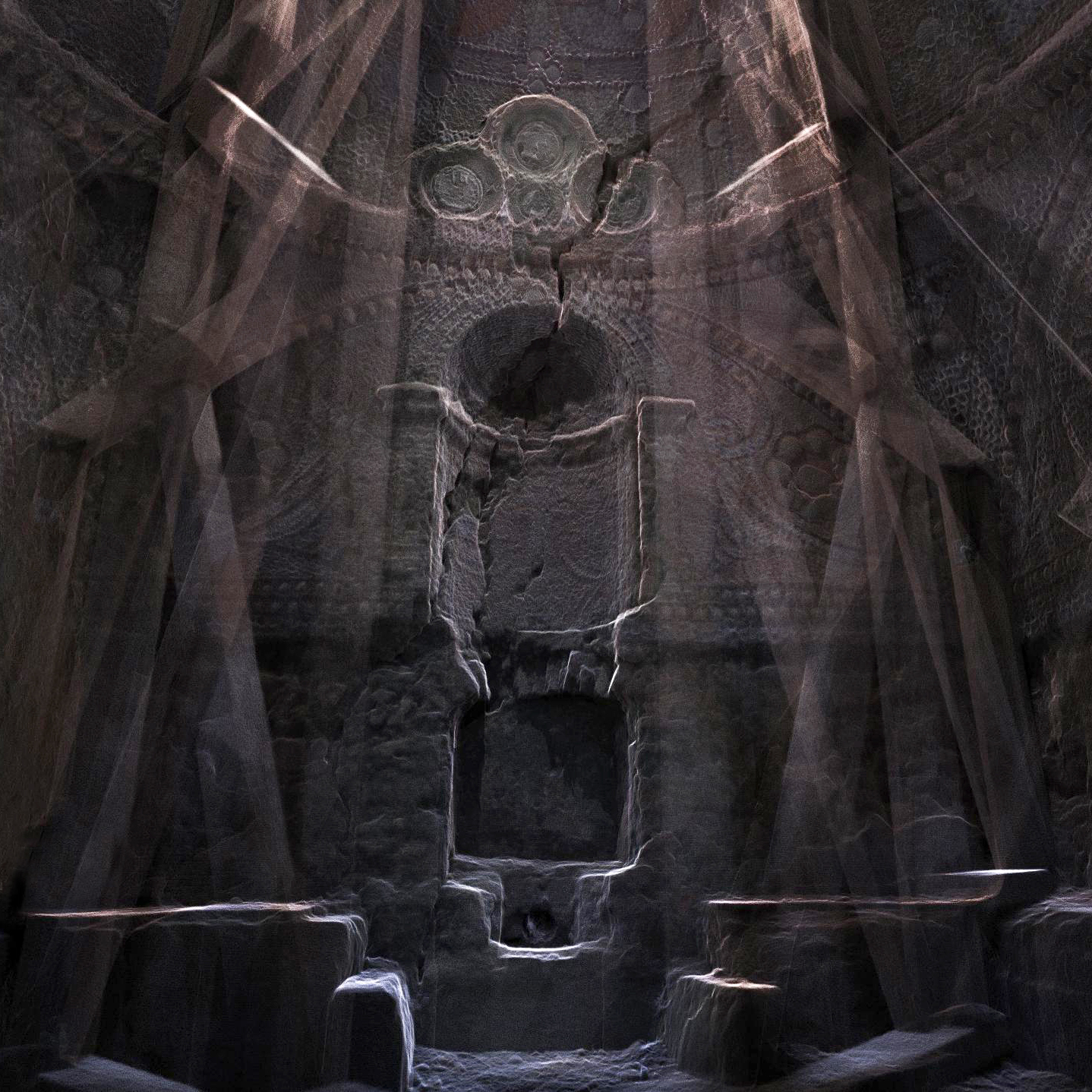
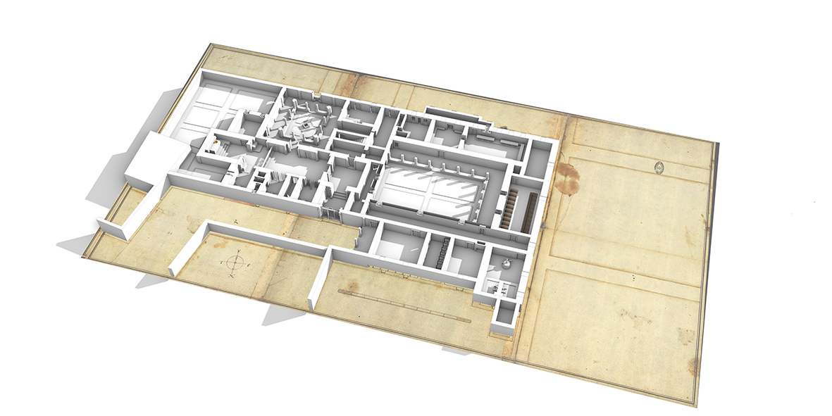
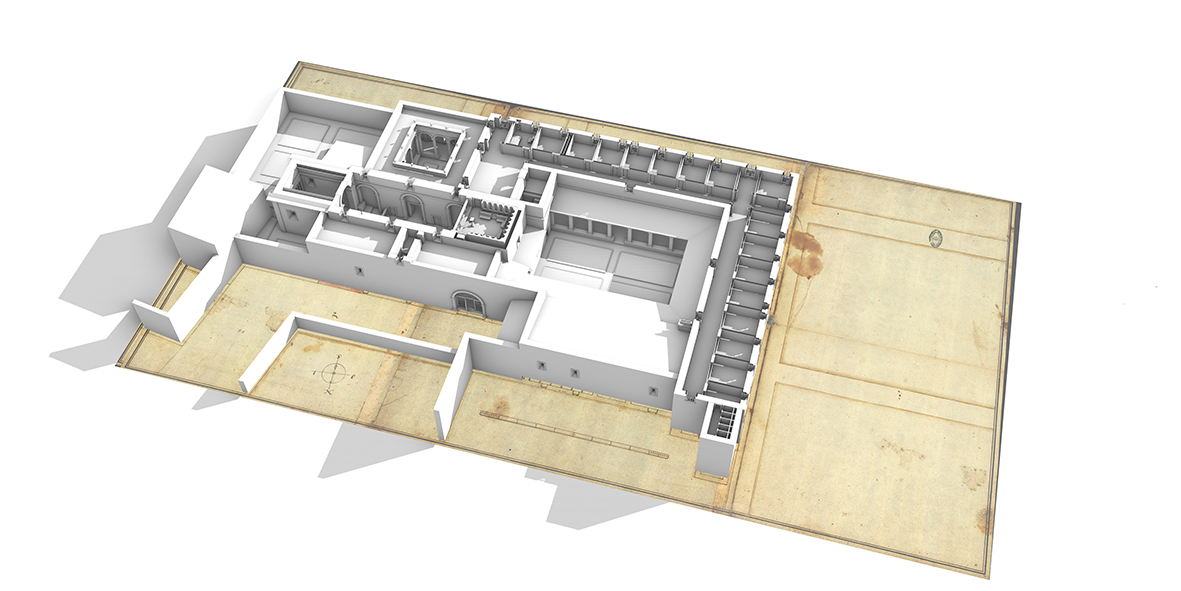
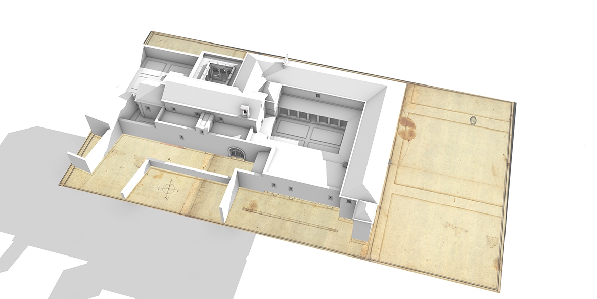
Sequence of images showing the final virtual reconstruction.
Mendes, Rui (2017) Os desenhos do Mosteiro de Nossa Senhora da Rosa de Caparica / 1593-1630 e o Arquiteto Régio Luís de Frias Pereira, ARTIS – Revista de História de Arte e Ciências do Património, Nº5.
Acknowledgement:
Damiano Aiello (Carleton Immersive Media Studio, Carleton University)
Rui Mendes (University of Lisbon)
The Social Sciences and Humanities Research Council of Canada (SSHRC)
New Paradigm / New Tools
Instituto Superior Técnico – University of Lisbon
Tokyo College – The University of Tokyo