
HBIM Course 2025-2026: Monastic Water Systems
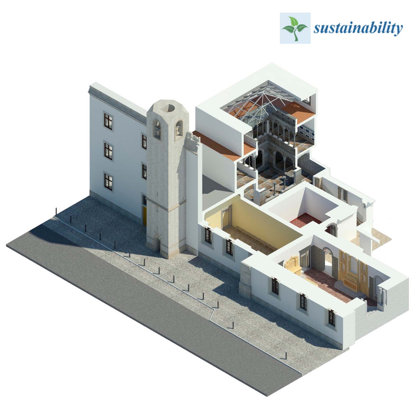
This year’s Historic Building Information Modelling (HBIM) was undertaken as part of AQUA-REVIVE, an ongoing Horizon Europe research project focused on deciphering and virtually reconstructing the convents and hydraulic systems of the Capuchos Convent and São Paulo Convent located within the Quinta de São Paulo in Alferrara (Setúbal, Portugal). The course was integrated into the Master of Architecture program at Instituto Superior Técnico in Lisbon and functioned as an exploratory lab using HBIM workflows as tools for virtual reconstruction and storytelling. The work will contribute directly to the project by prototyping early methods for data management, digital modelling and research dissemination that can help contribute to future rehabilitation and heritage programming.
The study of monastic water management in Portugal is still in its infancy, but it is an expanding field of research especially as climate change intensifies water scarcity. Researchers have been seeking a better understanding of the long-term legacies of land and water use as forms of sustainable practice. This context makes these two convents a particularly valuable case study for investigating how monastic communities captured, stored, and distributed water across buildings and landscapes across centuries in a zone of the country with historically less surface water. The convents, like many across the country, are only partly documented and remain poorly understood because these buildings evolved over time and were often abandoned in the nineteenth century following the state’s abolition of religious orders.
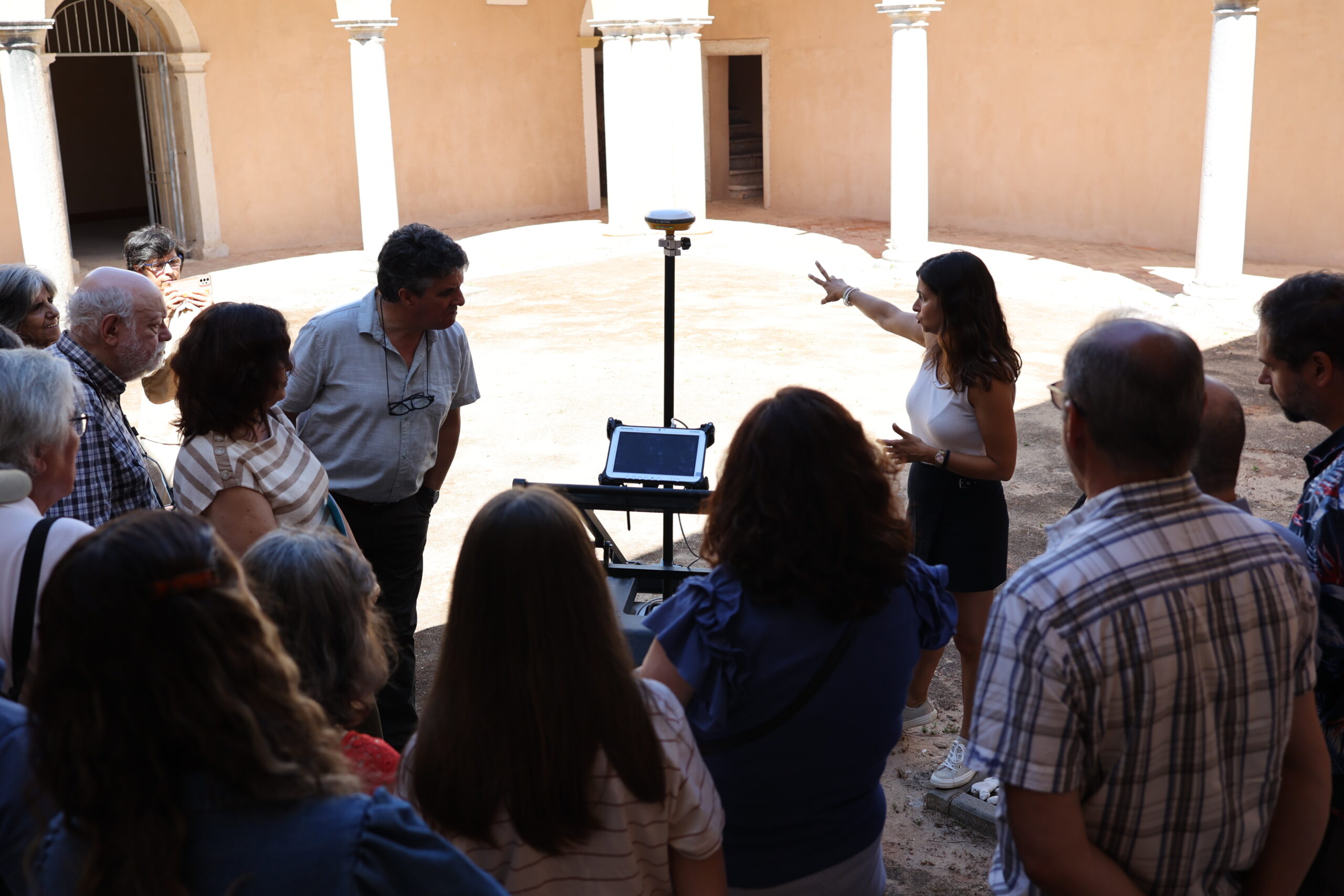
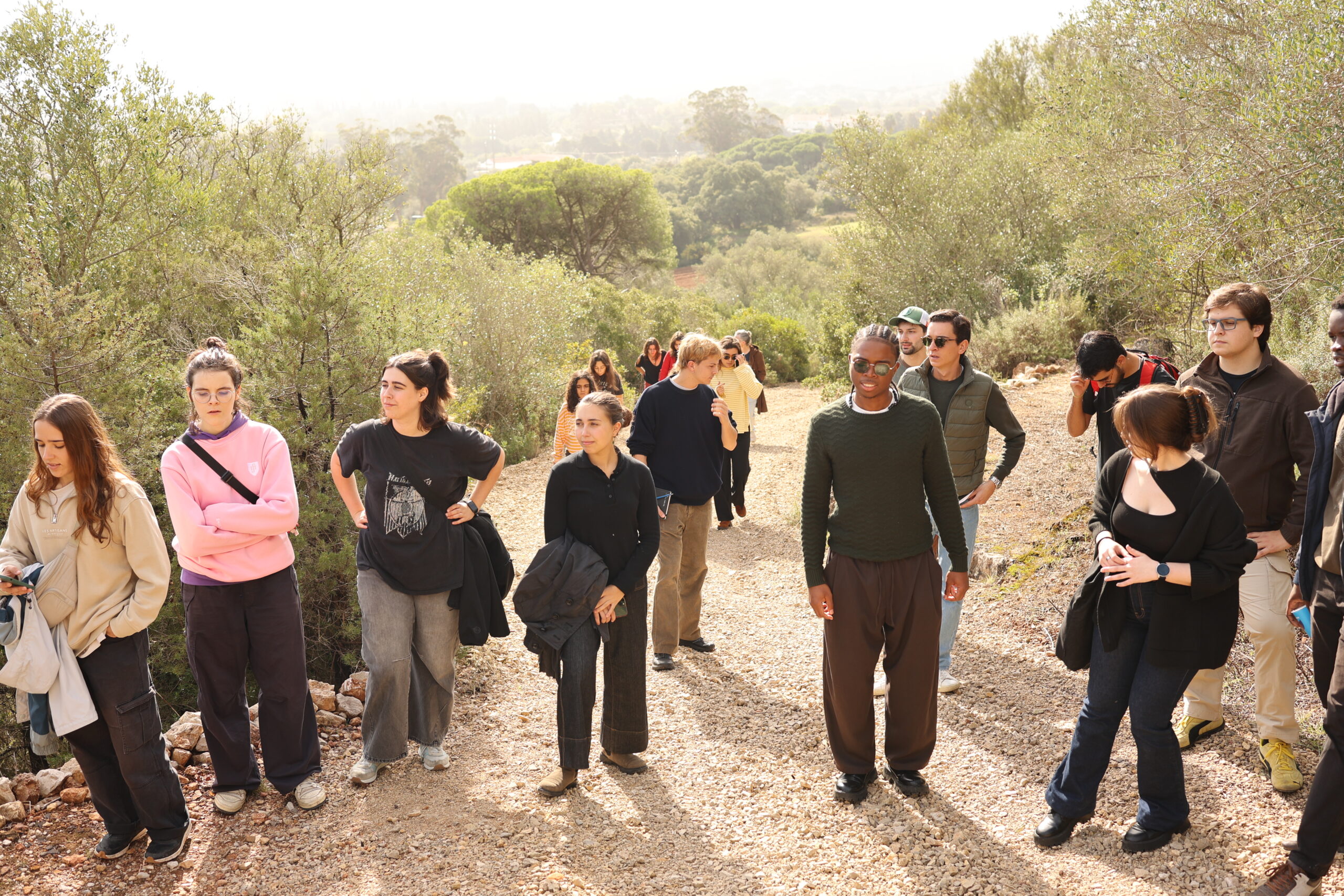
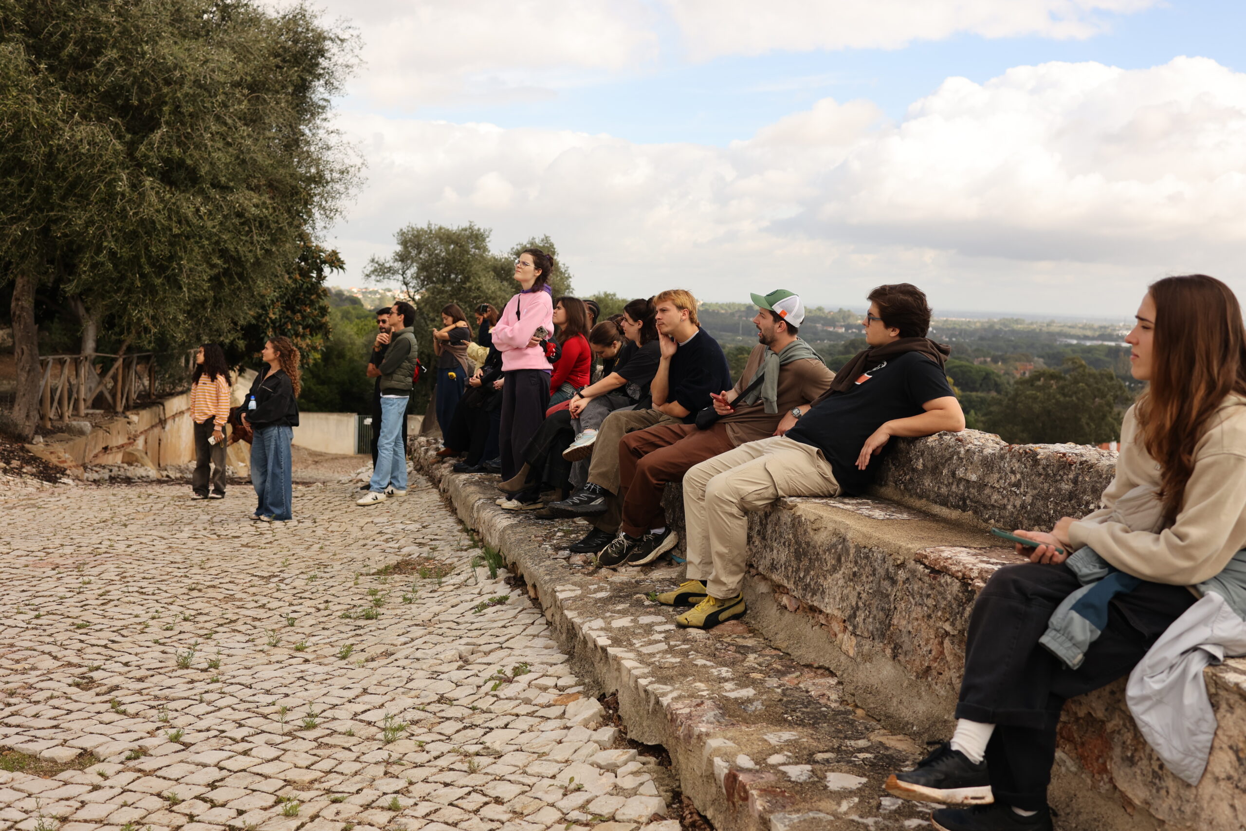
To begin this endeavour, students were introduced to the field of study and the case study. They proceeded by learning modelling practices from point cloud data, then applied these skills through nine group projects related to the theme of monastic water heritage at the convents. Their work connected physical evidence, historical interpretation and extended tools for HBIM dissemination to achieve a better understanding of how these systems once functioned. To anchor the work in a shared evidence base, the teams integrated a prior analog survey of the hydraulic systems by Pina in 1996, results from Inês Almeida’s virtual reconstruction, an extensive laser scanning campaign of both hydraulic systems undertaken in summer 2025, and preliminary studies produced through an earlier hors les murs exchange studio.
With this background, the course prioritized what could be evidenced with current datasets and explicitly identifying the knowledge gaps where future research, interpretation, or subsurface investigation would be required. In addition, a central aspect of the semester was to communicate results, making all the interpretive work legible to diverse publics and to facilitate comprehension—not only of hydraulic system functions but the processes leading to their understanding (i.e. how historic references and inference get translated into digital environments). This led to the exploration of various digital assisted storytelling approaches, cataloguing websites, virtual tours and even AR applications.
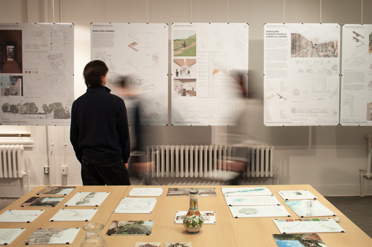
We are pleased to present brief snapshots of these nine projects below:
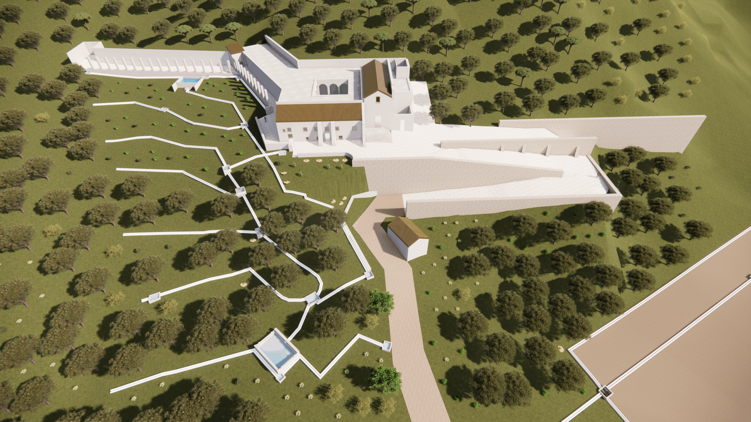
1) Reconstruction of the São Paulo Convent water system: This team virtually reconstructed the São Paulo Convent’s gravity-fed network based on a combination of documentation by Pina (1996) and recent point cloud data collected in the summer of 2025. Because most of the irrigation channels and tanks are completely buried, the model could only be partially verified, requiring the team to test hypotheses about missing or buried connections. In these cases, Pina’s documentation was used to support the terrain reconstruction as well as the slopes of irrigation channels. Point clouds, meanwhile, enabled accurate massing of the convent, surrounding landscape features, and key visible hydraulic elements. Because many parts of the hydraulic and irrigation systems are no longer visible, the students documented their decision-making and speculative interpretations (commonly referred to as “paradata”) in a 2D portfolio, clearly distinguishing measured evidence from inference. They also communicated the system through Enscape and Twinmotion storytelling to provide a comprehensive visual representation of how the system may have functioned, allowing the public to immediately understand how the convent’s former monks could have sustained themselves across centuries.
2) Reconstruction of the Capuchos Convent water system: The hydraulic system in this case is simpler than at São Paulo because the Capuchin friars relied more heavily on alms from local communities and wealthy patrons and therefore did not need to sustain themselves solely on food they produced. Nonetheless, the existing ruins pose significant ambiguity about how water flowed through the site. There are many missing connections between visible elements that have to be assumed at this stage by logical inference. To clarify how the system functioned as a whole—while also respecting the truths revealed by the ruins themselves—the project adopted a “middle-way” approach, modelling the ruin in its present condition along with a plausible reconstruction of its former state. To distinguish physical evidence from speculation, the project used generic features and material transparency wherever there was doubt but explored full material tectonics in the case of visible elements. The final model was exported into an Unreal Engine environment to facilitate interactive communication of the results. This included a custom user interface featuring a “lens of the past” toggle, allowing users to contrast present-day ruins with their reconstructed hypotheses by visualizing missing structural data.
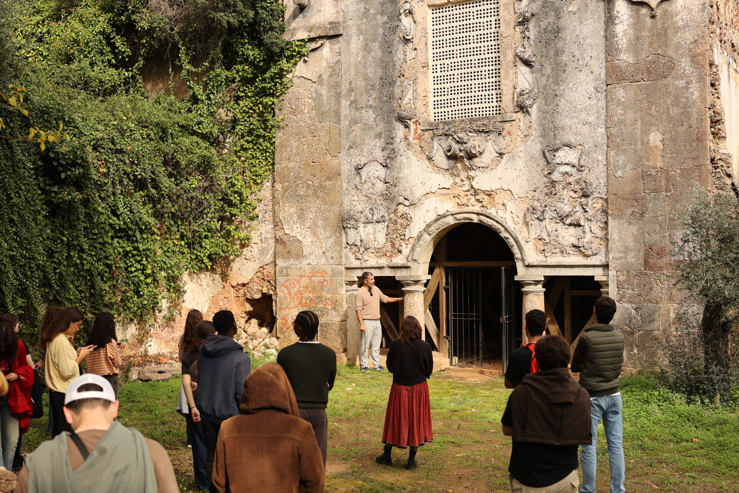
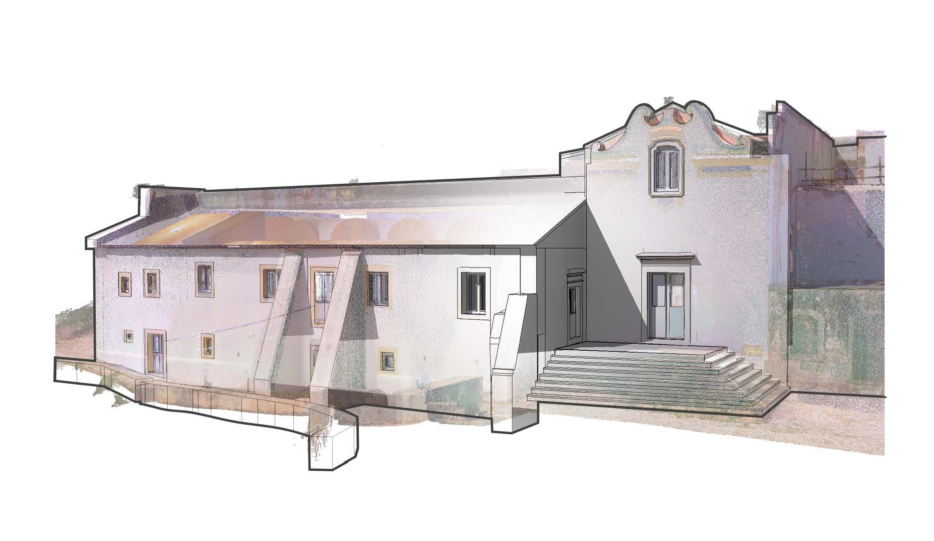
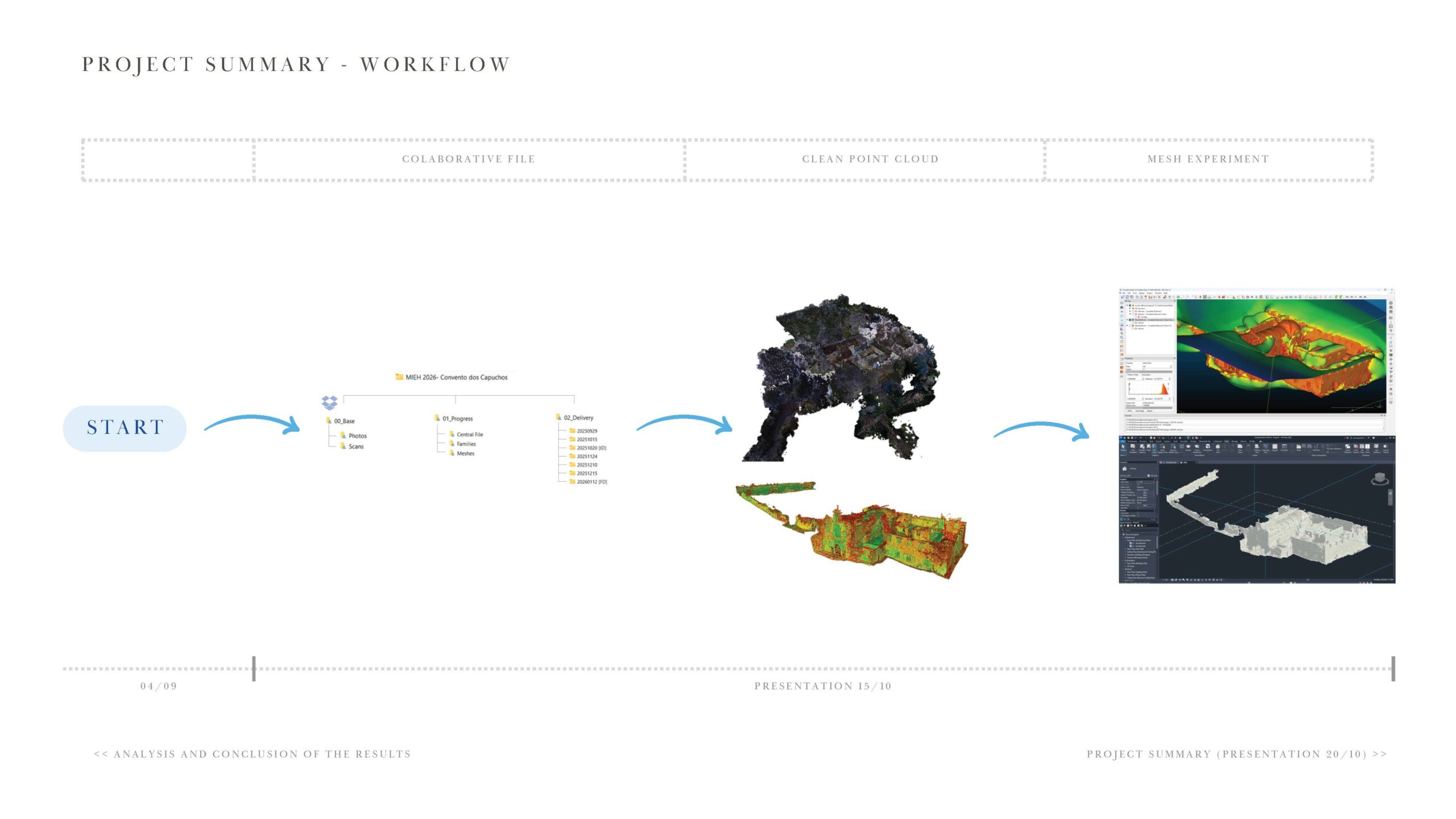
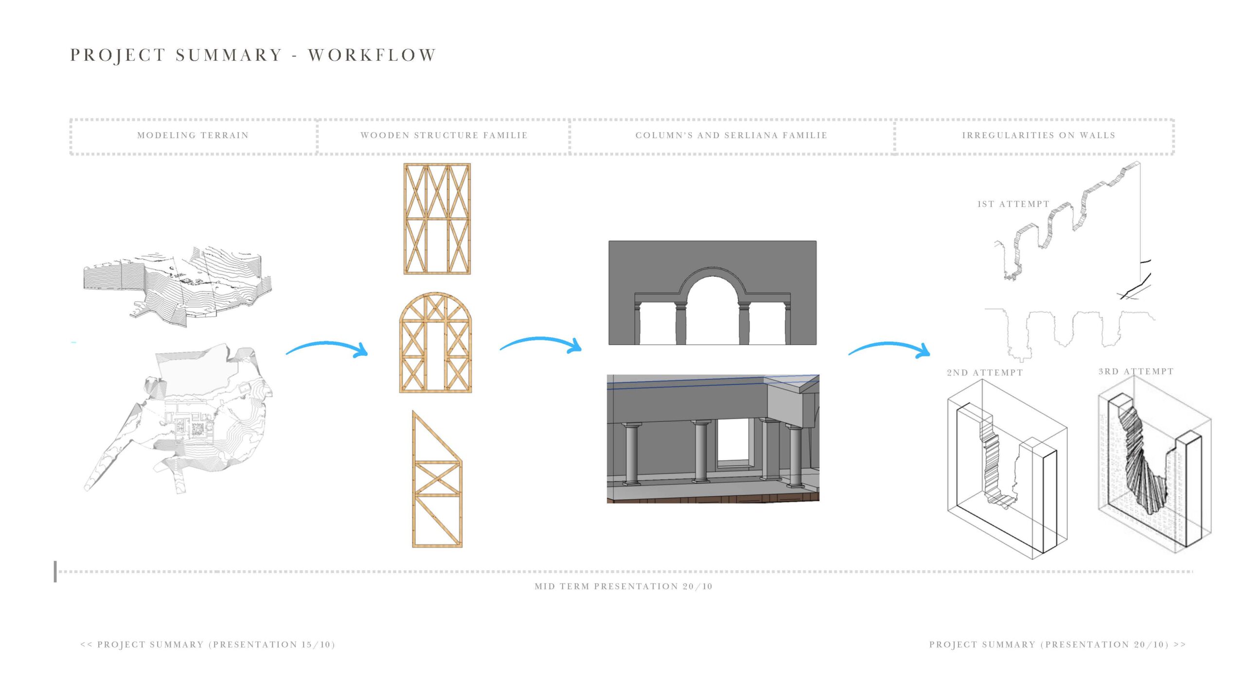
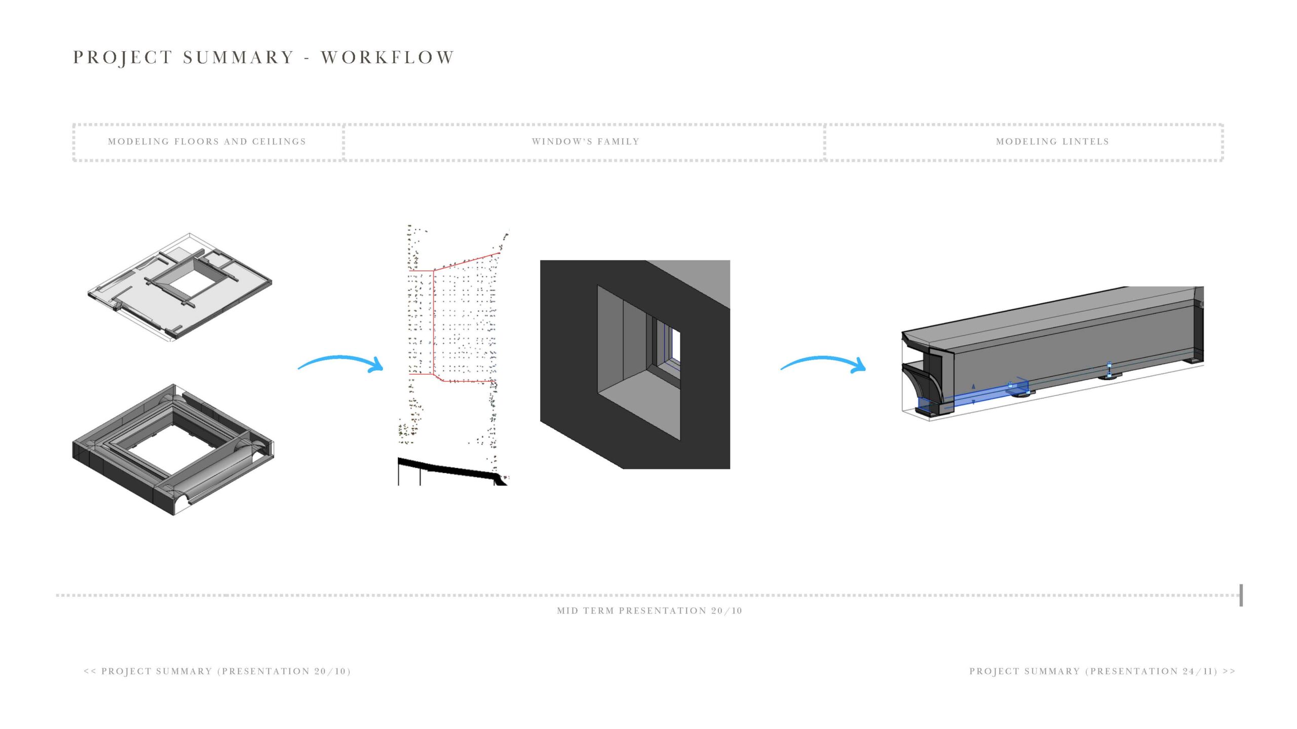
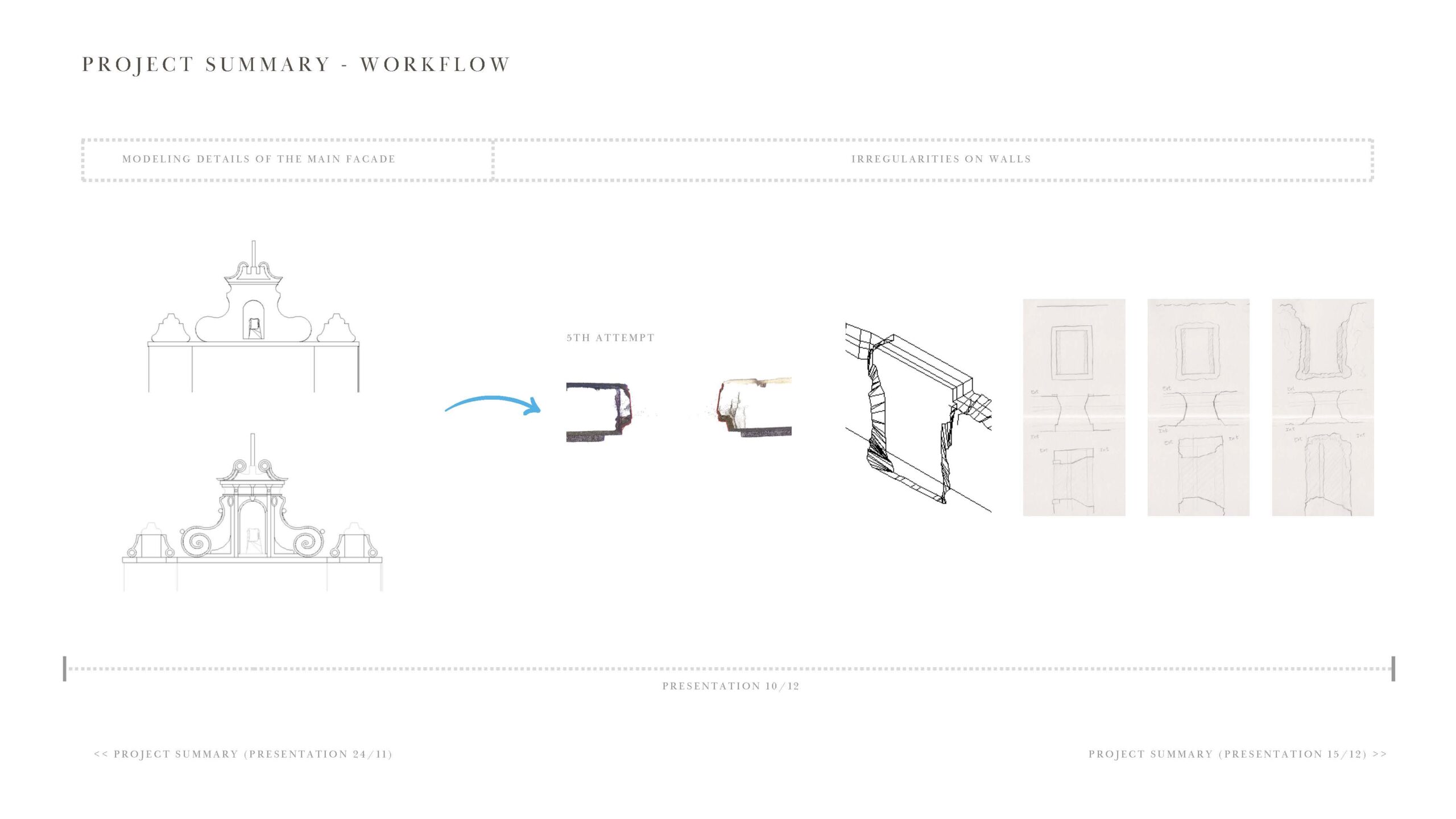
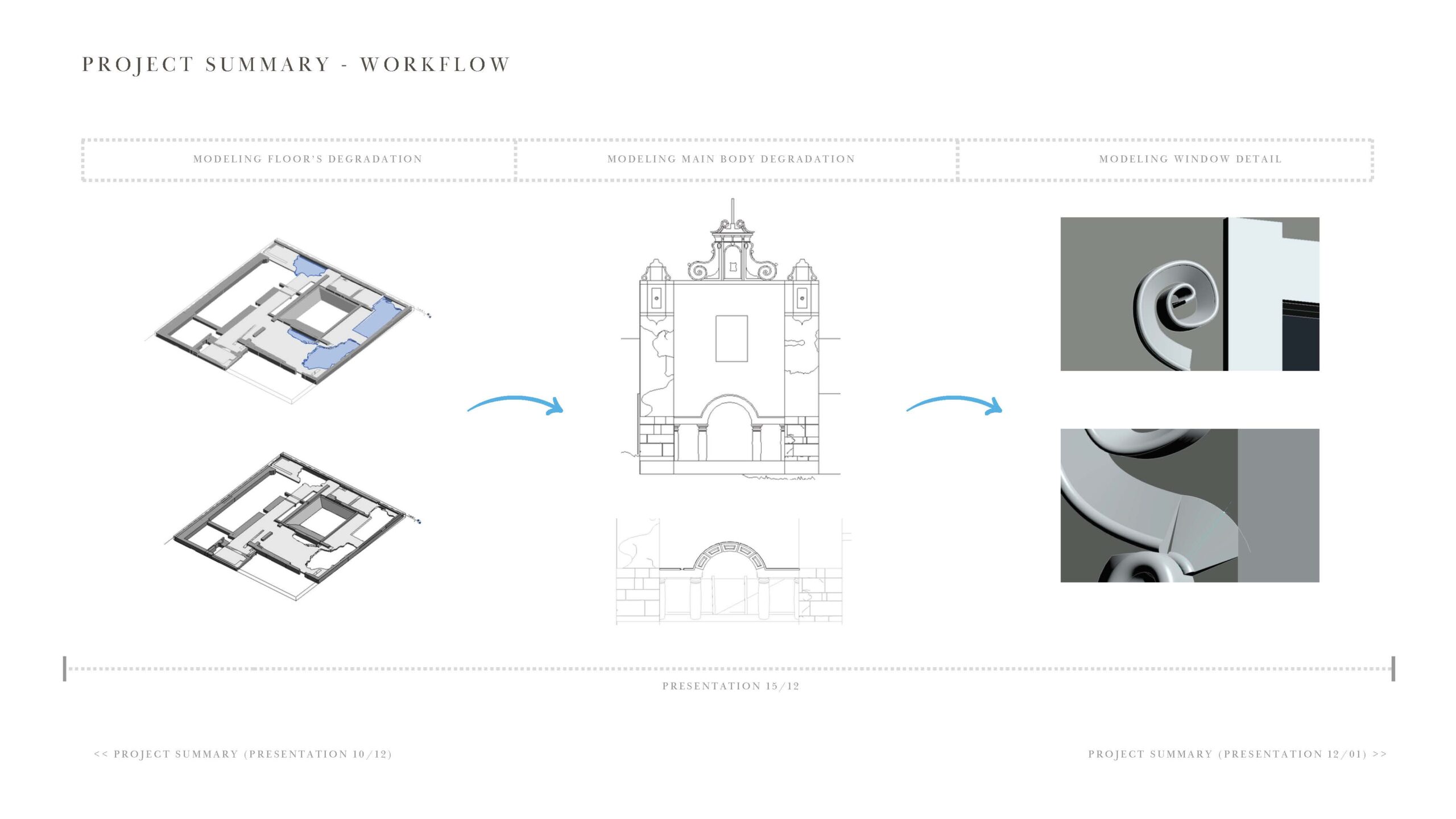
3) São Paulo Convent as-found recording: This “as-found” recording project focused on testing the limits of modern BIM software to capture the irregularity of heritage structures. As-found recording is an approach that documents the current, physical state of a site rather than its original intended design. In the context of heritage this preserves measured irregularity as much as possible, rather than normalizing the building into geometry that is easier for the software to produce. Although recent rehabilitation made the overall volume appear rectilinear, point cloud sections revealed persistent deformation, non-planarity, and localized inconsistencies that required iterative modelling, especially in cases of non-perpendicular wall alignment and the insertion of windows and doors. Exterior walls and buttresses were modelled first, then adjusted against interior walls through repeated cross-checking in plan and section views of the point cloud. Each team member took responsibility for a category, e.g. windows, doors, walls and floors. Collaboration workflows from the beginning were needed to ensure that these different modelling categories aligned. It also required careful anticipation of how window and door families could be fitted within non-orthogonal wall conditions. On-site analog recording also played a key role in refining the digital model: profile measurements of arches, door frames and other details were used to verify whether deviations in the scan data reflected meaningful deformation or scan noise.
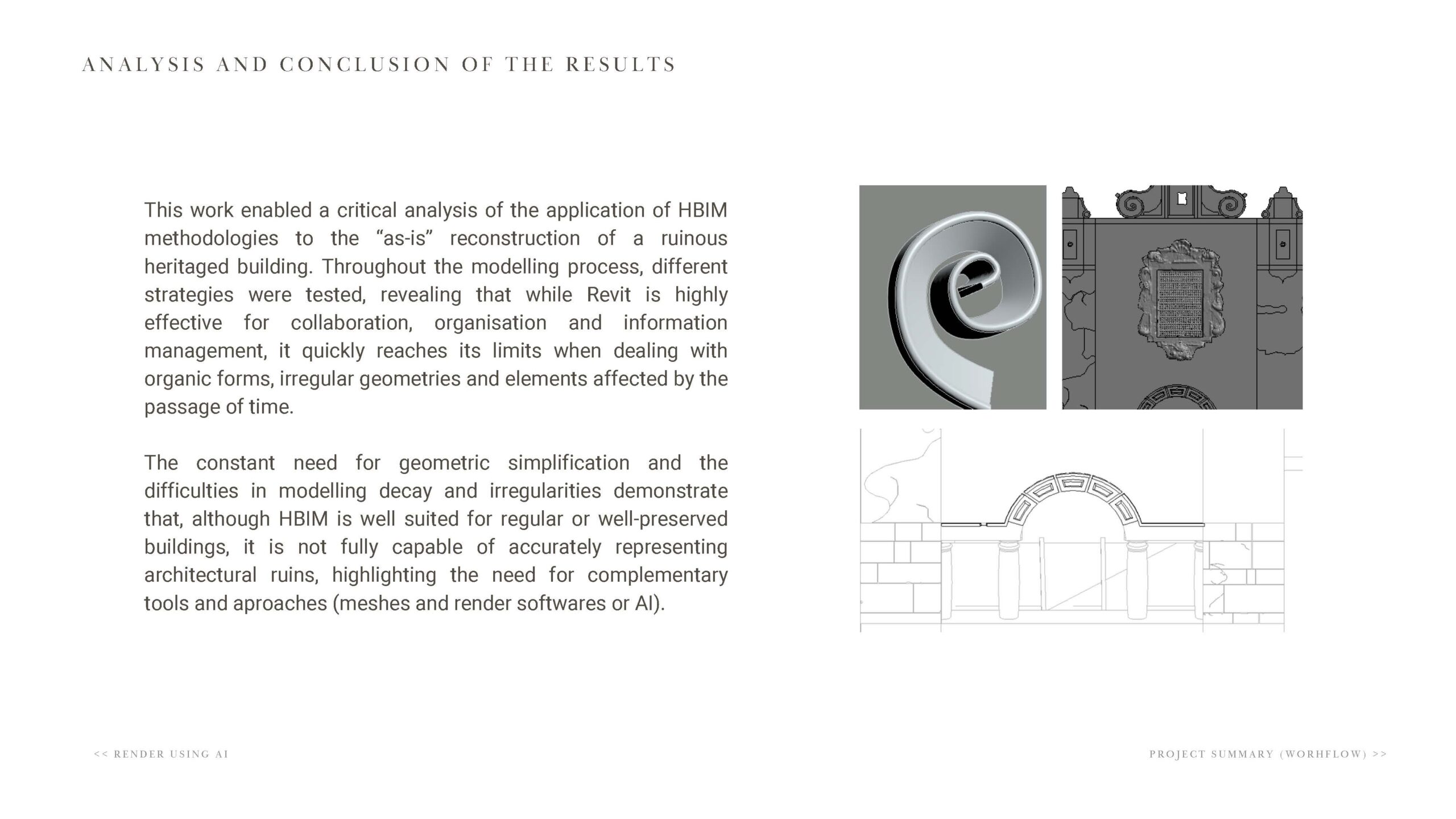
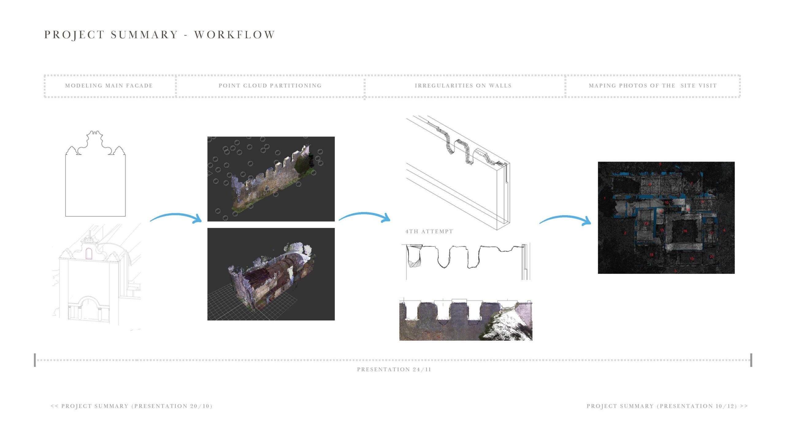
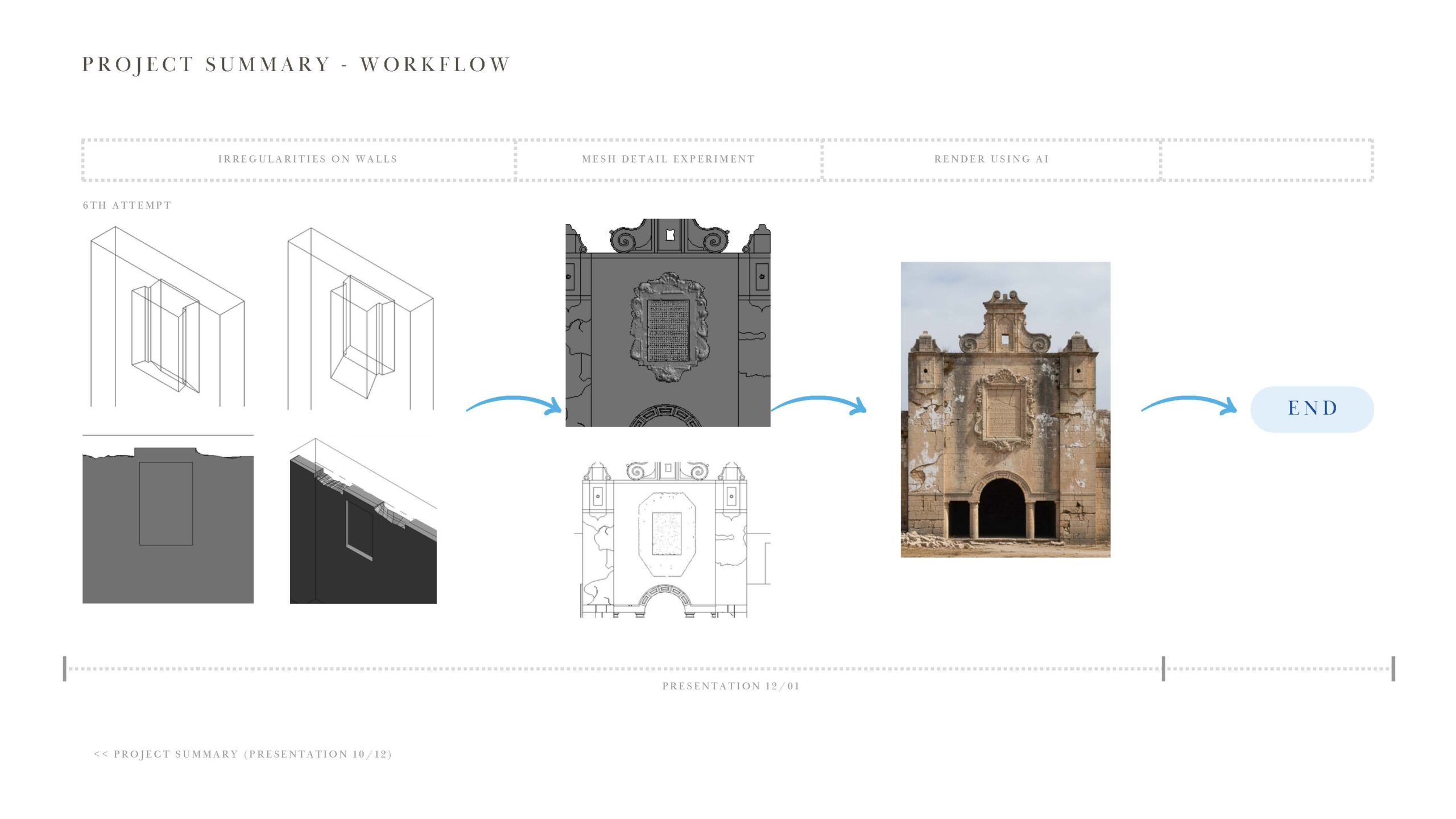
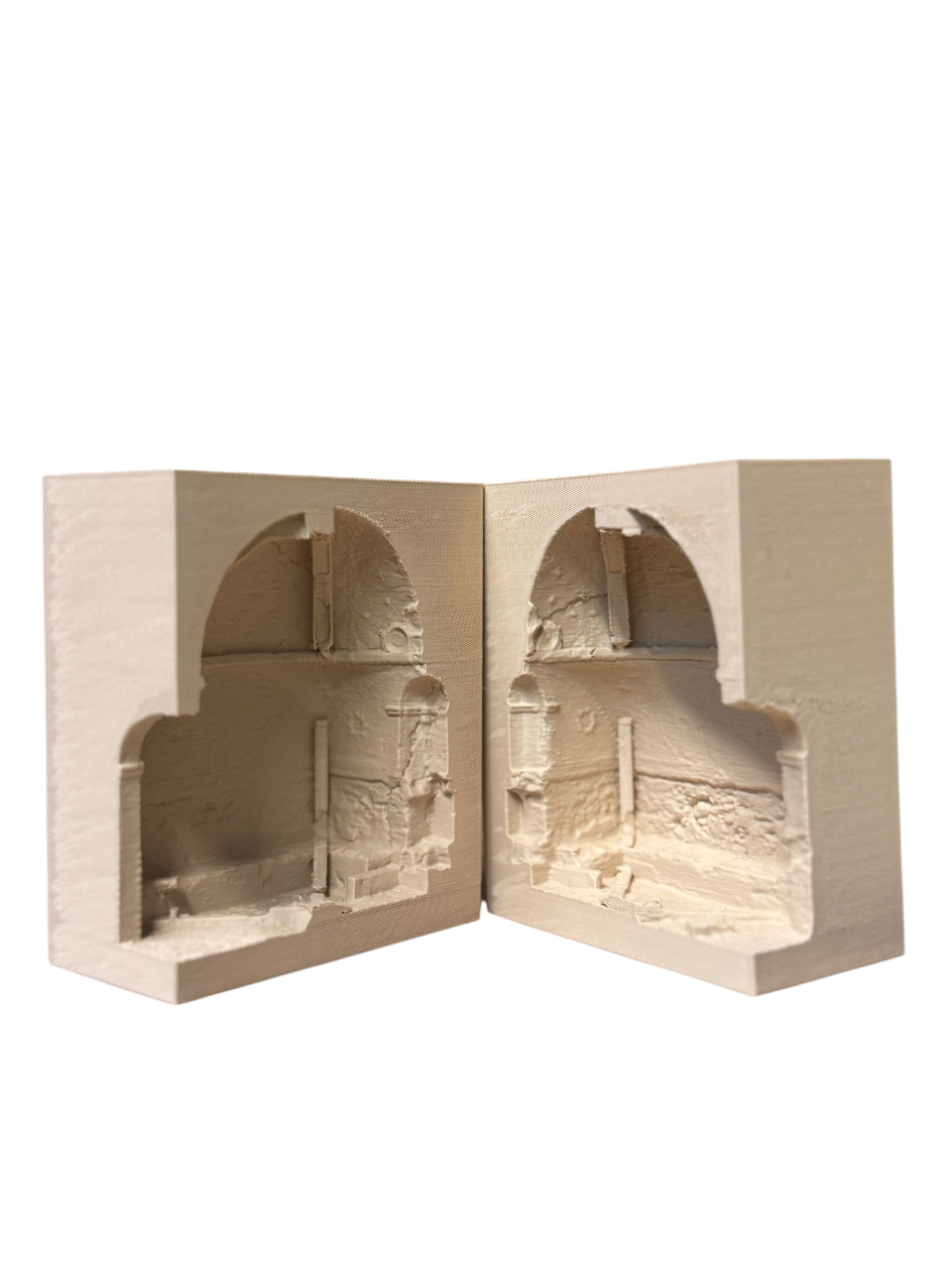
4) Capuchos Convent as-found recording: The Capuchos Convent is an extreme as-found modelling scenario since the building is in an advanced state of ruin involving material loss, overgrowth, deteriorated decorative features, and other complexities. The students fully tested the limits of conventional BIM software, which is better suited to standardized components and regularized building assemblies. They opted for an exploratory approach developing a hybrid workflow that combined point cloud interpretation with mesh-based modelling. The process began with cleaning and segmenting the scan data to remove vegetation, isolate the temporary timber supports used to stabilize the structure, and reduce overall noise with automatic reduction tools. The point cloud was then divided into modelling zones for easy coordination. Highly decorative fragments of the facade, which exceeded practical parametric modelling limits, were reconstructed as triangulated meshes derived directly from cleaned point clouds and imported into the HBIM environment. The project was key because it led us to conclude that there is no uniform method for reliably capturing geometry in Revit while also preserving the visual character of ruin “as-is”. Instead, a more simplified and strategic approach is needed, using targeted 2D documentation for some areas and mesh-based modelling for geometrically complex or highly deteriorated zones.
5) AR dissemination prototypes: This project prototyped mobile augmented reality (AR) applications by extending analog survey material and HBIM data into Unity. The applications enable users to view and interact with overlaid hydraulic system elements to facilitate comprehension of the quinta as well as the analog survey document that was used across all other group projects as a source of evidence. Through clickable and scrollable hotspots, users can access images, interpretive notes, and source references. In one iteration, the application responded to the complexity of the original 2D quinta survey (1996) and the inherent difficulty of reading dispersed technical information across the multiple page thesis document that accompanied it. This approach helped re-establish a clearer connection to the original survey artifact by making its content more legible and navigable. In another iteration of the prototype, HBIM models were generated from a combination of point cloud data and analog survey documentation for the quinta. These models were used to represent hydraulic lines, nodes, and key architectural features at a relatively low level of detail, allowing users to better understand the site’s overall construction logic and water pathways.
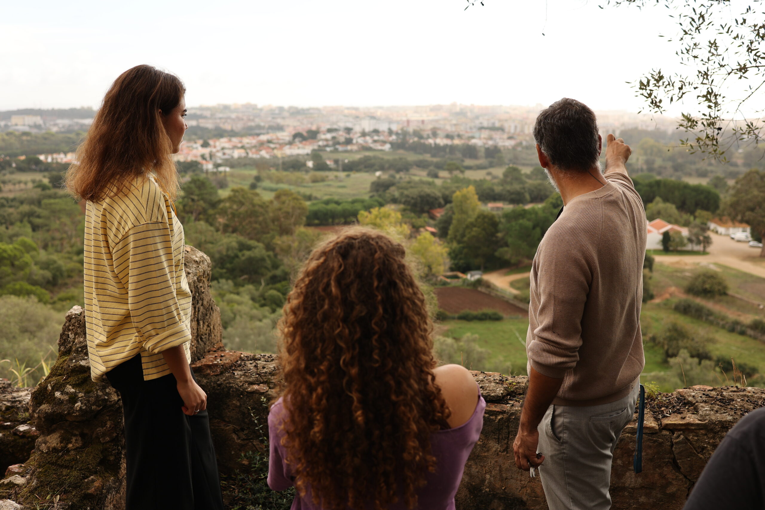
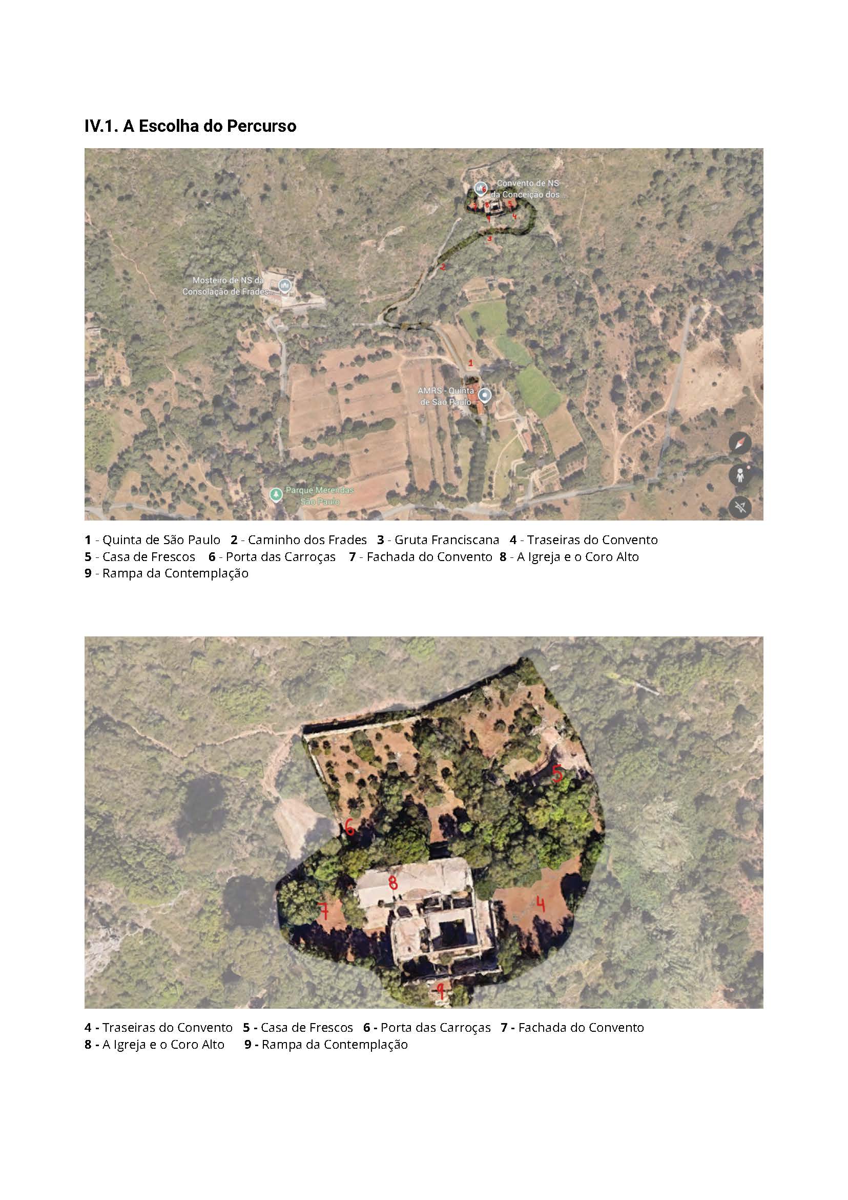
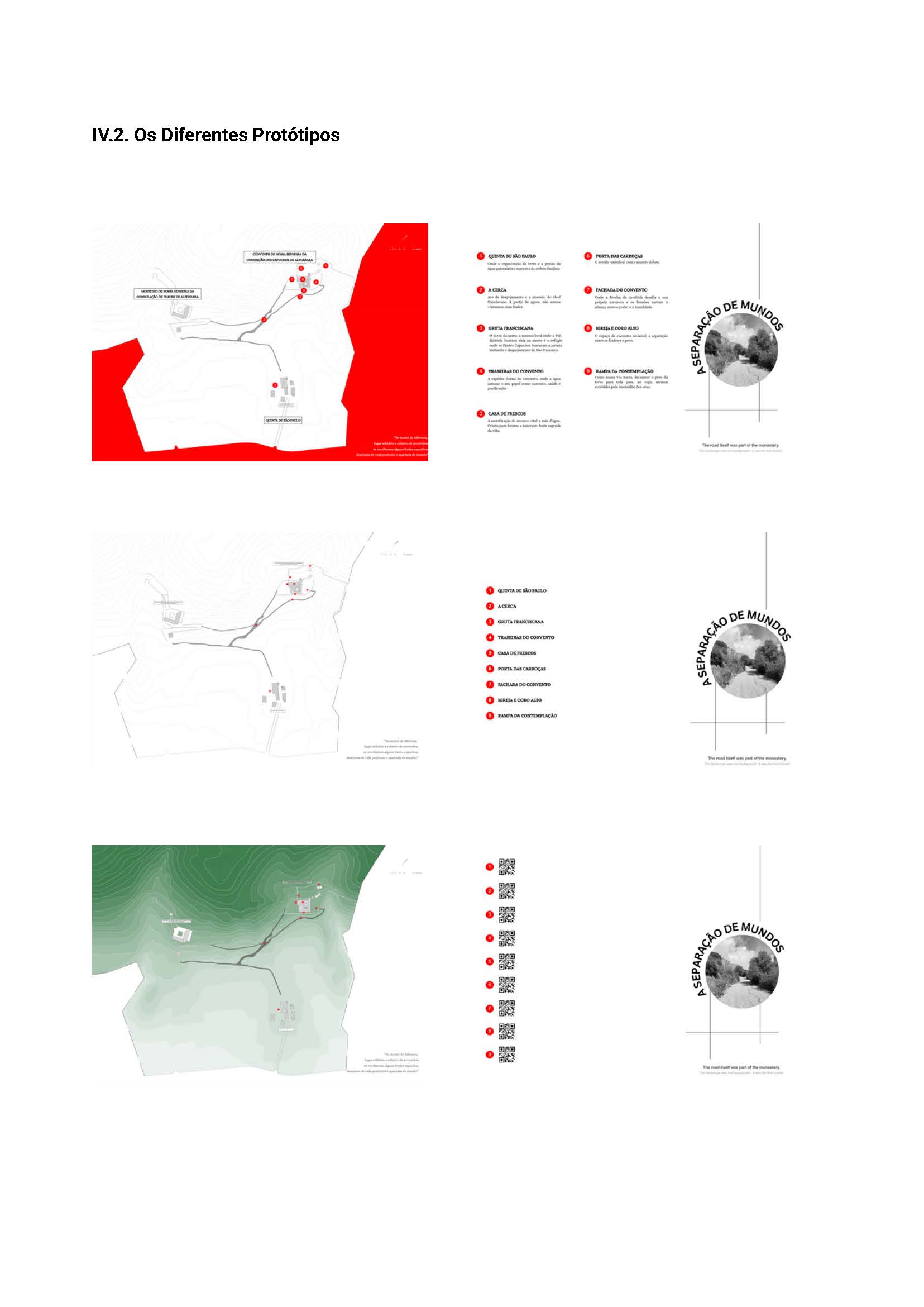
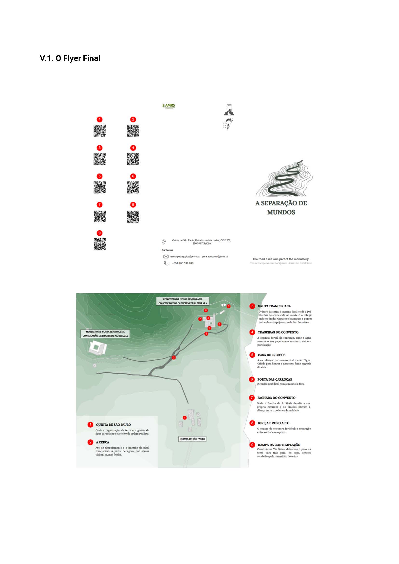
6) Digitally assisted storytelling: This storytelling project for the Capuchos Convent developed a heritage-interpretation strategy that translates historical research into an accessible visitor experience. The process began with theoretical and graphic research, structured through a shared working document to identify the site’s key narratives, emotional qualities, and possible communication formats. An on-site visit transformed the team’s understanding of the convent and its landscape, revealing that a lighter, more immediate format would better support real-time exploration than an HBIM approach. The concept therefore evolved into a visitor flyer organized around a curated route from Quinta de São Paulo to the convent, highlighting key points such as the prehistoric cave, Casa de Frescos, façade, church, and contemplation ramp. The final design combined a mapped itinerary, short evocative texts in an audio-guide tone, and QR codes linking to audio descriptions. Rather than prescribing interpretation, the project frames storytelling as a simple, immersive system that helps visitors construct their own experience of the place, while remaining adaptable to future digital or on-site signage formats.
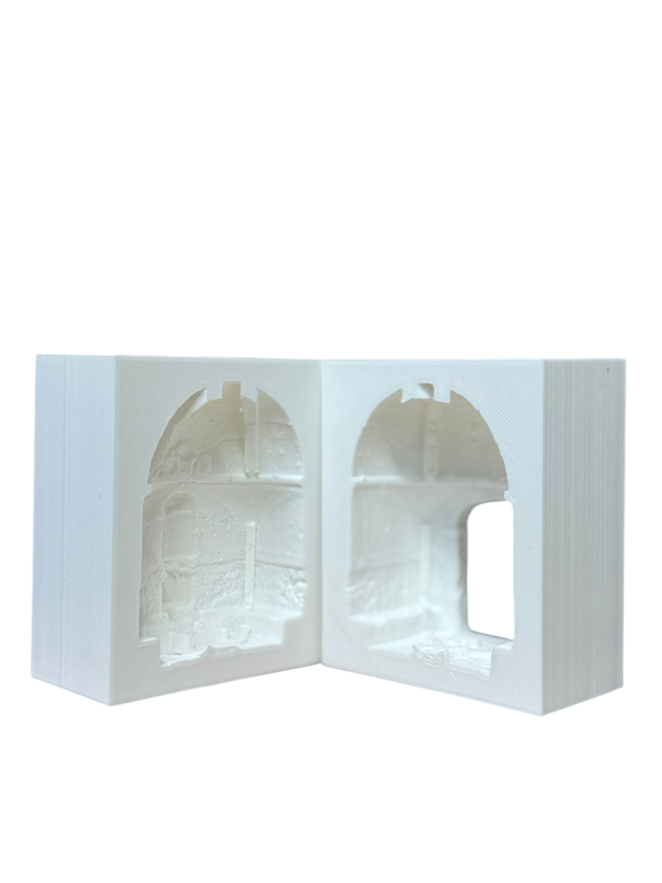
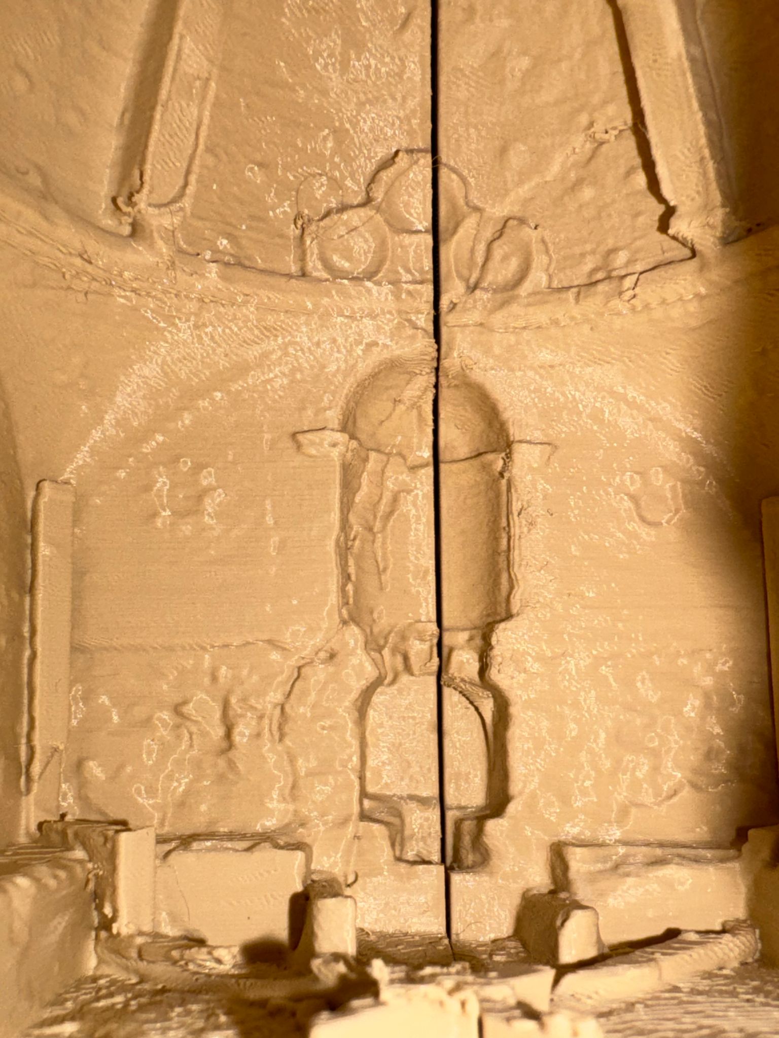
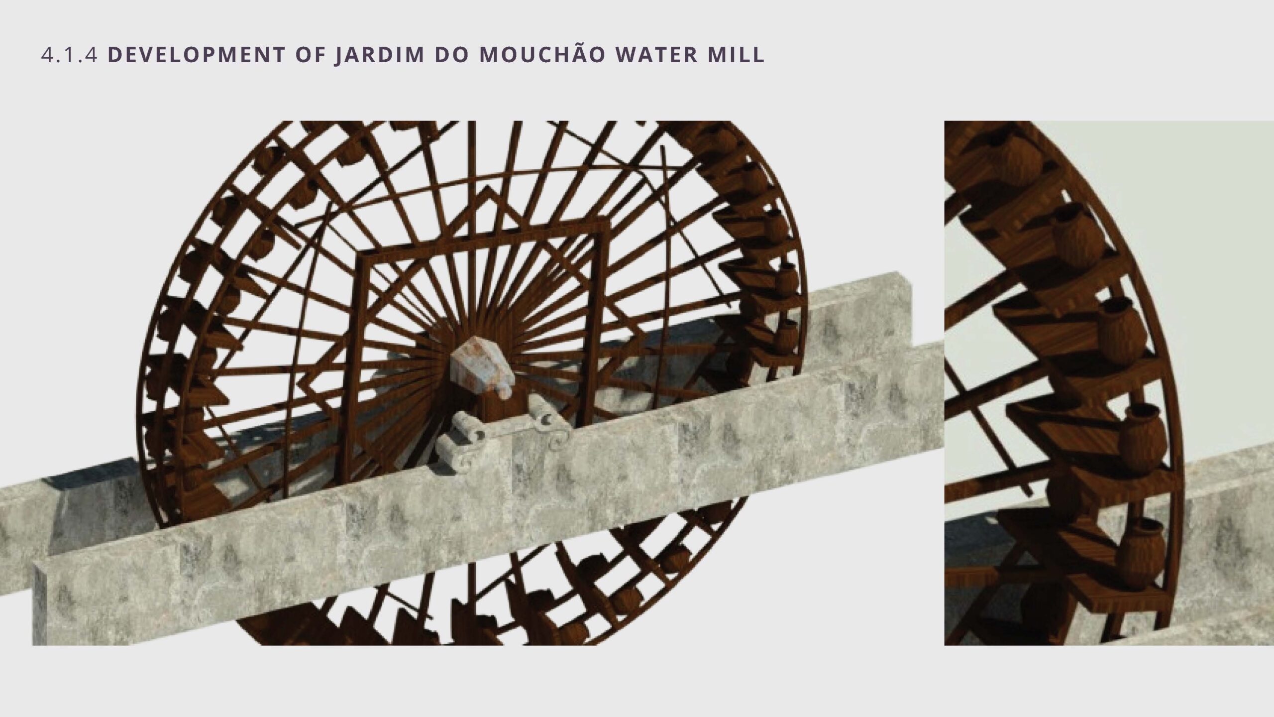
7) 3D printing as-found conditions: This comparative project explored 3D printing as a communication method for as-found documentation using the cooling houses (casas de frescos) of both convents as a common scenario to test different modelling strategies for best representing condition of decay. In Portuguese convents and estates, these cooling structures functioned as retreat spaces, using the cooling effects of moving exposed water and cave-like structures to create environments for rest and refreshment during hot and dry summer months. While the São Paulo cooling house is highly deteriorated and currently stabilized with a temporary timber support, the Capuchos Convent has been more recently restored and thus retains largely regular geometry with only some localized areas of exposed masonry on the façade and interior floor. These differences prompted different digital modelling approaches prior to printing. For the São Paulo case, an all-mesh workflow was used to preserve as much as of the surface distortion, cracking, and irregular material conditions with high fidelity. For the Capuchos case, a hybrid workflow used HBIM solids modelled from point clouds to create the primary architectural volumes with mesh inserts in areas of exposed irregular masonry. The models were then merged and repaired to produce watertight STL files suitable for printing at reduced scales.
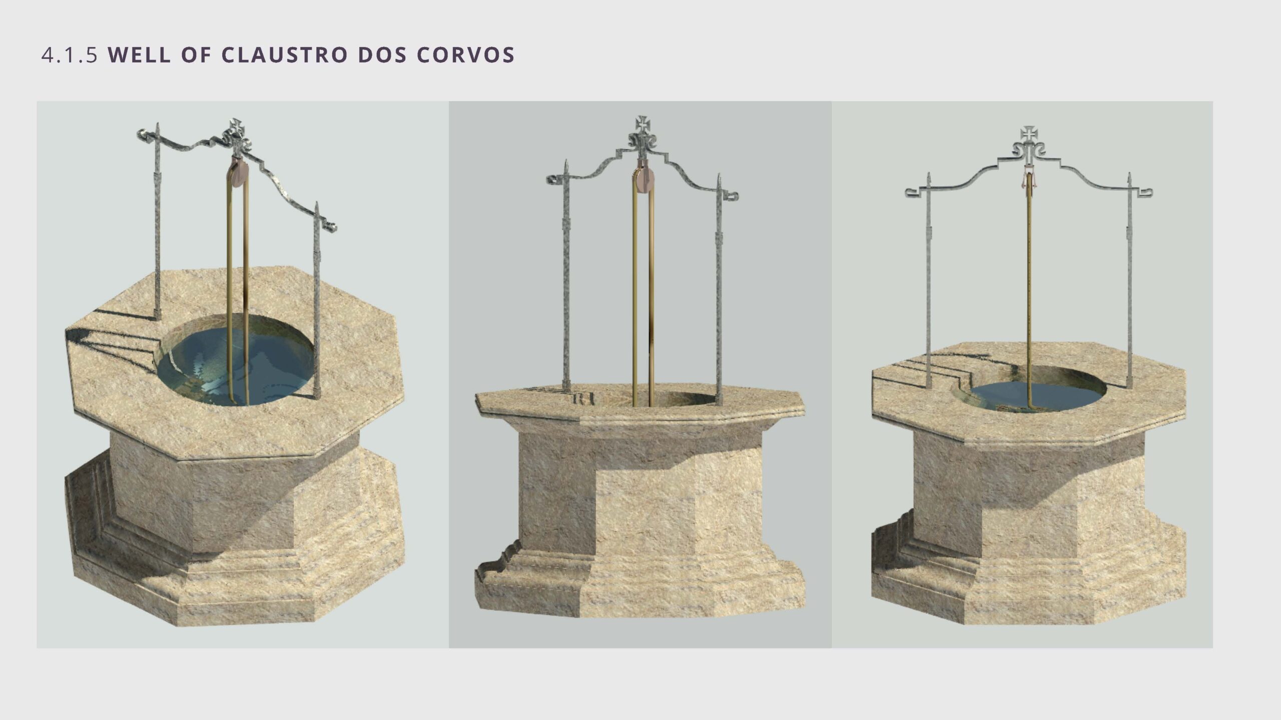
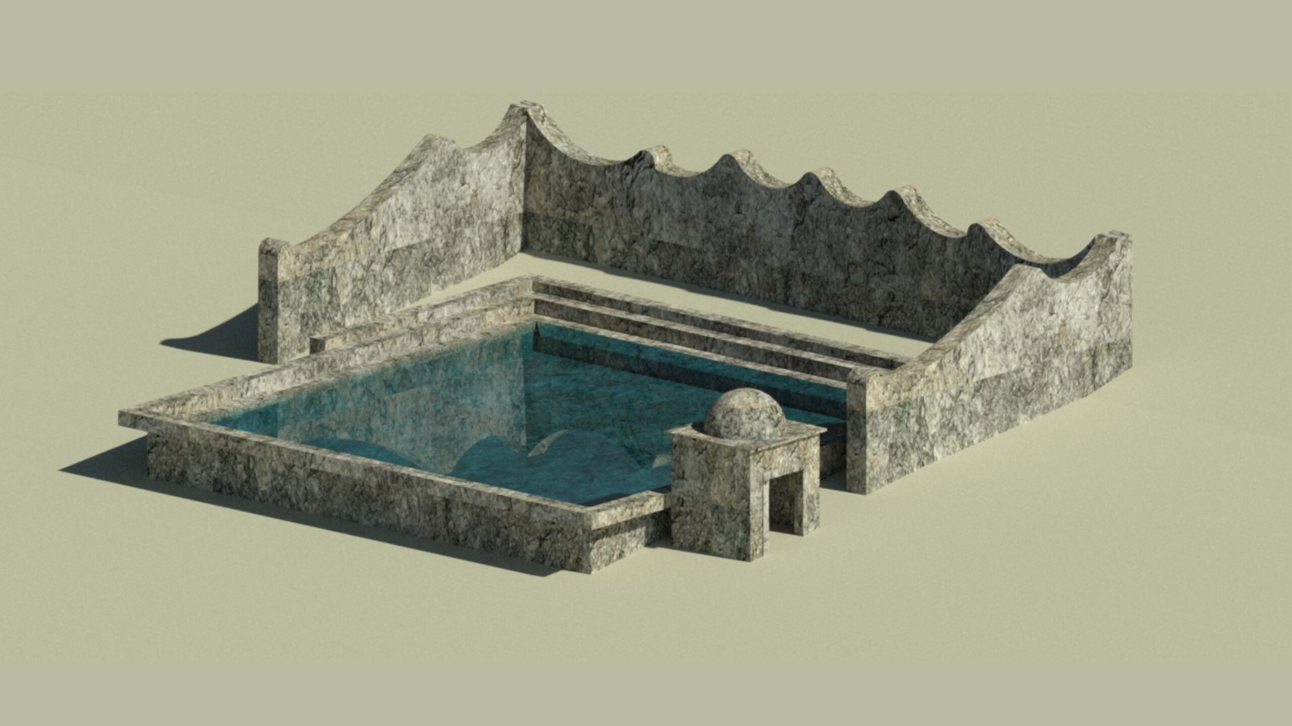
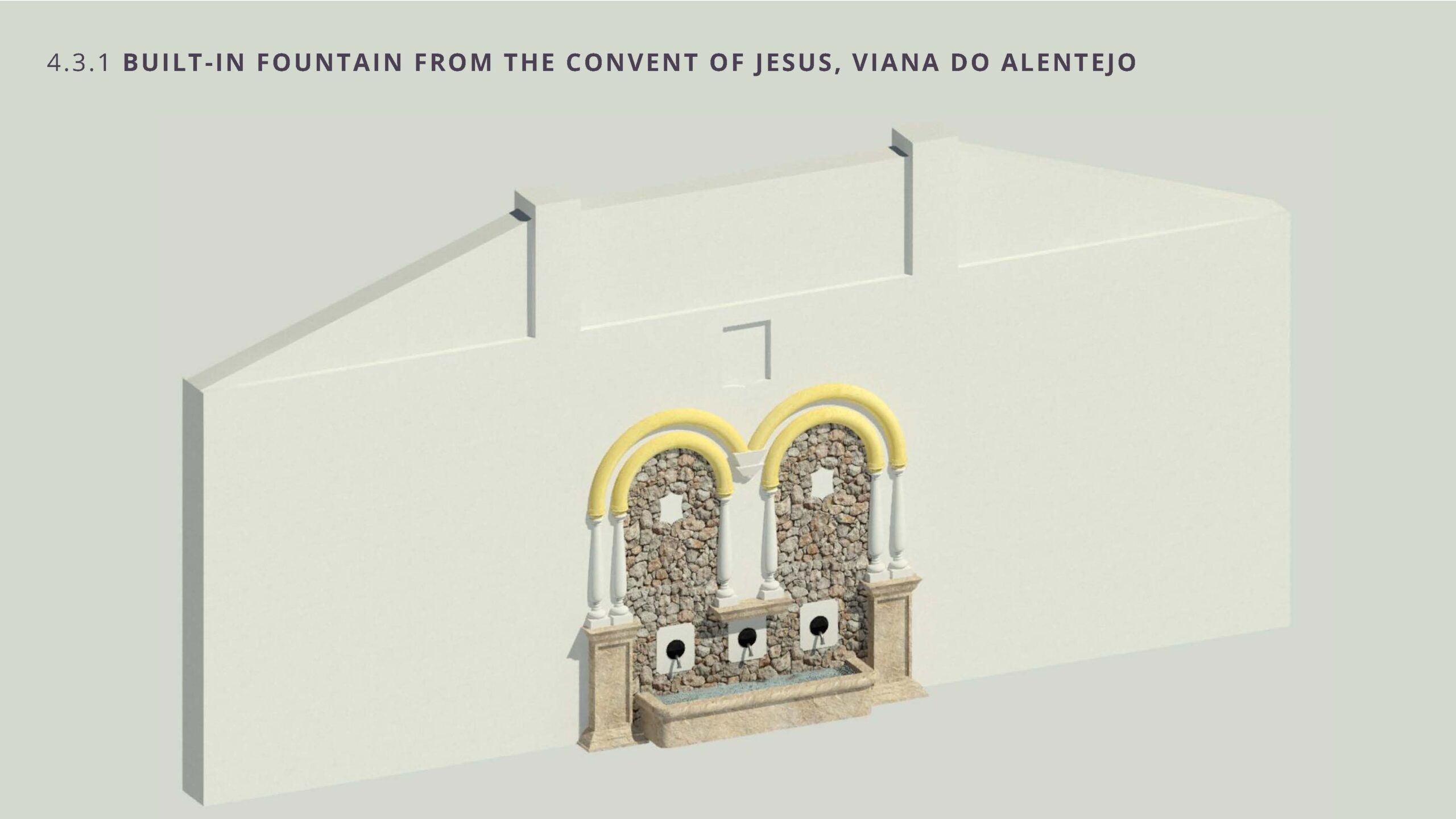
8) Monastic Hydraulic System Modelling and Cataloguing: Expanding the scope of the semester beyond the quinta itself, this research explored a digital approach to monastic hydraulics as a field of research using literature review and case-study comparison of sites around Portugal. The work is organized into three outputs: an analytical report, synthesis maps and a 3D catalogue of hydraulic and architectural components. The team used the opportunity to explore other infrastructure like aqueducts, reservoirs, and water mills that were not part of the work at the quinta. A contribution was the creation of topographic and drainage maps of continental Portugal using QGIS and AutoCAD with available open geospatial data. An HBIM component catalogued aqueducts, reservoirs, fountains, wells, mills, and lavatoriums from several Portuguese sites. Due to the difficulty of accessing the sites firsthand, they resorted to using photo-based proportional estimation to produce coherent, interpretable digital reconstructions for comparative study and educational use. A proposed website format combining Sketchfab exposes the research, allowing for data organization, open access, and communication for wider audiences.
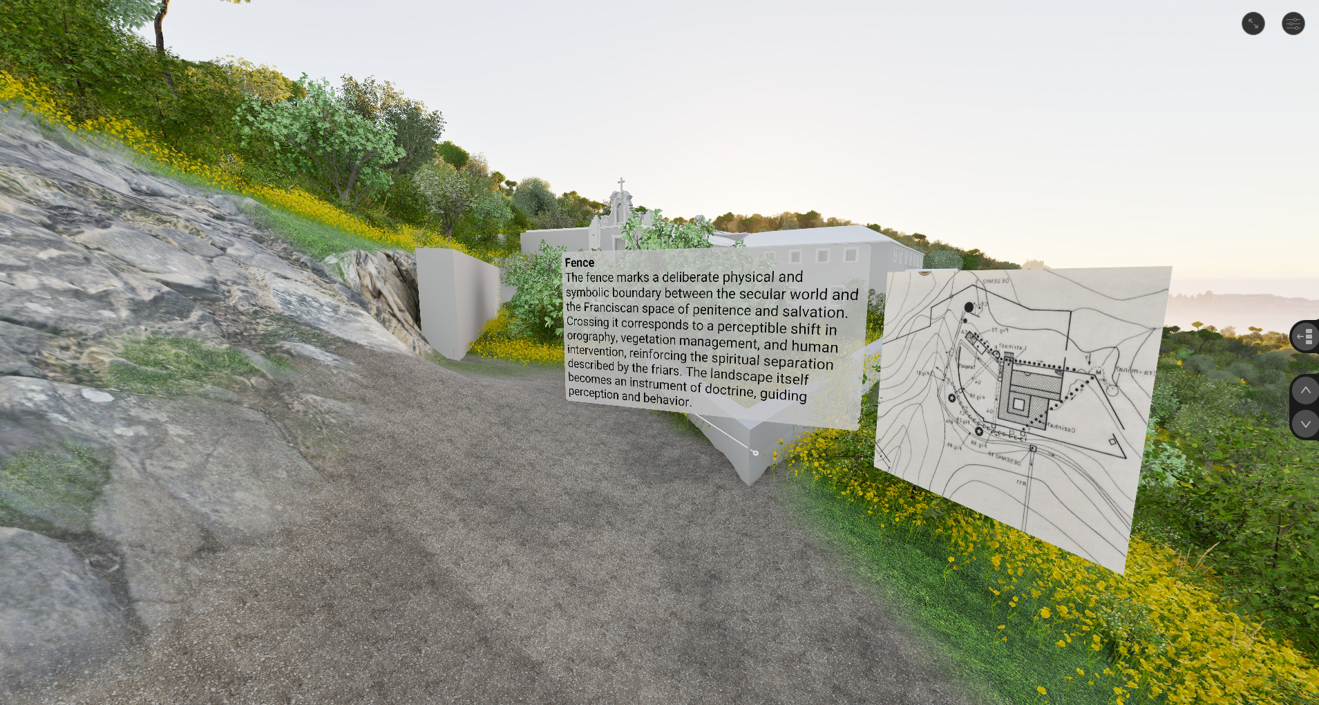
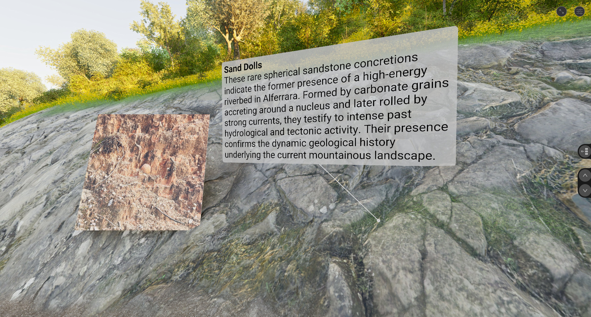
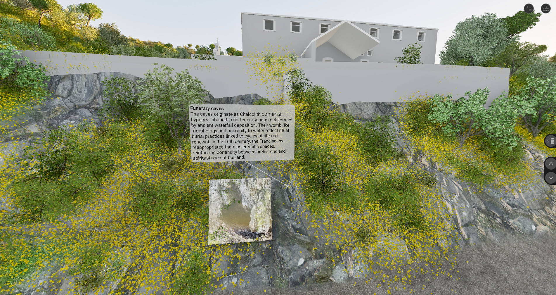
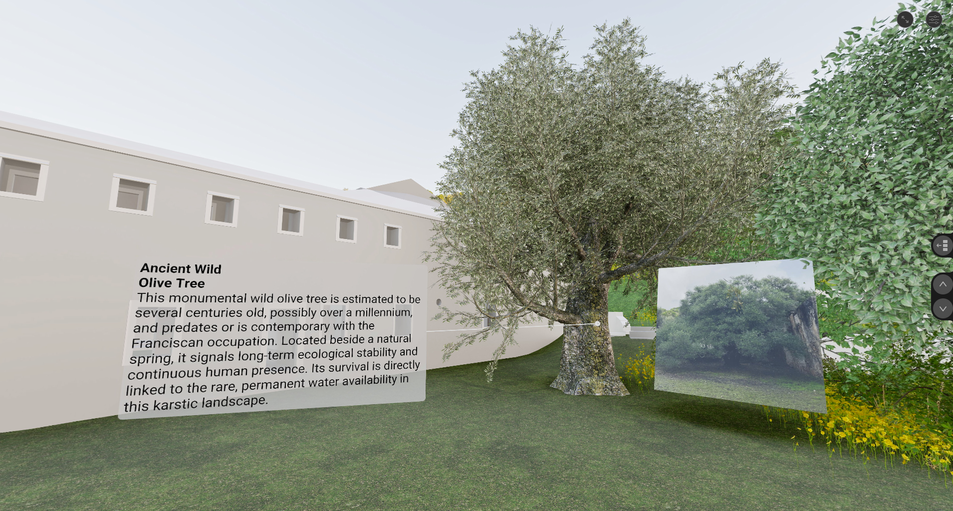
9) Visualizing the Quinta’s Geological History: This geology-focused project was developed as a digital storytelling strand that reframed Quinta de São Paulo as part of a hydrogeological cultural landscape shaped across deep time. Drawing on field observation, site visits, and interviews with the site manager and local experts, the students explained how the Arrábida region’s permeable limestone and dolomitic formations, together with fractures and faults, concentrate water in springs and other hydraulic points that made long-term occupation possible. They then connected this legacy to prehistoric life including man-made caves, agricultural practices, and later monastic life. The final prototype was conceived as a virtual educational landscape connecting HBIM and Twinmotion to integrate building, terrain and vegetation. The experience produces guided render sequences and embeds annotated hotspots linking notes and images to features such as sand dolls, karst caves, the Mãe d’Água, breccia elements, and other site details.
This work was financially supported by JSPS KAKENHI (grant number 25K17761) carried out at Tokyo College, The University of Tokyo and by the European Union’s Horizon Europe research and innovation programme under the Marie Skłodowska-Curie grant agreement No. 101207766. This research was also funded in part by the Fundação para a Ciência e a Tecnologia, I.P. (FCT, https://ror.org/00snfqn58) under Grant UID/6438/2025 of the research unit CERIS.